Top Qs
Timeline
Chat
Perspective
Dipaculao
Municipality in Aurora, Philippines From Wikipedia, the free encyclopedia

Remove ads
Dipaculao [ˌdiːpɐˈkuːlaʊ], officially the Municipality of Dipaculao (Tagalog: Bayan ng Dipaculao; Ilocano: Ili ti Dipaculao), is a municipality in the province of Aurora, Philippines. According to the 2024 census, it has a population of 33,597 people.[5]


.svg)
The municipality is home to the Dinadiawan River Protected Landscape.
Remove ads
History
Summarize
Perspective
Early history and etymology
The name Dipaculao was first documented in Spanish records in 1719, when the Misión de San Miguel de Dipaculao was established by the Franciscan priest Sebastian de la Madre de Dios.[6][7][8] The mission was aimed at converting the indigenous Ilongot people who lived on the preexisting settlement variously recorded as either "Ipaculao" or "Dipaculao." The mission was headed by a series of Franciscan missionaries originating from Baler, though they were all largely unsuccessful at converting the Ilongot and the nearby Casiguran Dumagat Agta.[8]
By 1870, the settlement was recorded as being depopulated and largely abandoned by the Ilongot, who had moved to rancherias (indigenous villages) closer to the Spanish settlement of Casignan (also spelled "Casecnan" or Casiguan", now Maria Aurora) to grow rice and various other crops for trade in the local markets.[8] The few remaining inhabitants of the settlement that arrived with the Spanish are believed to have primarily consisted of Ilocano migrants, since the mission was recorded as Ilocano-speaking in Spanish publications from as early as 1865 and 1869.[8][9]
The mission and the original native settlement was bounded by Casiguran to the far north, Baler to the south, and Casignan to the northwest. It was situated on an island bordered by the saltwater Dipaculao River, which merges with the Casignan River (also known under the names Bicanili and Cabatangan) to the north and an unnamed river to the southeast of Baler.[10][11]
It is unknown if the settlement was named after the Dipaculao River or vice versa. The location of the Dipaculao River is also now unclear due to changes in river topography. It is likely the same river that now flows through Lobbot, Lipit, and Ipil. The prefix "di-" ("of the" or "coming from"), is a common prefix in place names of the Ilongot people. The meaning of the rest of the name is unknown.[12]
American colonial period
In 1921, more migrants from Central Luzon (mostly Ilocanos from neighboring Nueva Ecija, La Union, and Pangasinan) settled in Dipaculao.[13][14] Igorots from the Cordilleras also came down to lived alongside Ilocanos and the aboriginal Ilongot.[14][15] Other ethnic groups who came to and stayed in Dipaculao include Christianized Gaddang and Isinai settlers who settled the surrounding lowlands of Baler Bay, Gaddang from Nueva Vizcaya and Mountain Province and Isinai from Nueva Vizcaya.[16] Later that year, the large strip of land where the municipality is located was returned to Tayabas (present-day Quezon Province).[17]
Modern era
On November 27, 1950, Dipaculao was converted from a barrio of Baler into an independent municipality of Quezon via Executive Order No. 375 by President Elpidio Quirino, with 16 other Baler barrios also being made part of the new municipality.[18] Anacleto Mijares was the first Municipal Mayor, and administered the transition.[19] It later became part of Quezon's sub-province of Aurora beginning in 1951.[20]
On June 21, 1957, the sitios of Dimabuno, Laboy, Dinadiawan and Puangi were converted into barrios.[21][22][23][24] Several more sitios were converted into barrios on June 18, 1966.[25]
The municipality later separated from Quezon and became part of the new province of Aurora on August 13, 1979.[26]
Remove ads
Geography
Summarize
Perspective
According to the Philippine Statistics Authority, the municipality has a land area of 361.64 square kilometers (139.63 sq mi) [27] constituting 11.49% of the 3,147.32-square-kilometer (1,215.19 sq mi) total area of Aurora.
Dipaculao is situated 12.54 kilometres (7.79 mi) from the provincial capital Baler, and 264.85 kilometres (164.57 mi) from the country's capital city of Manila.
Barangays
Dipaculao is politically subdivided into 25 barangays, as shown in the matrix below.[28] Each barangay consists of puroks and some have sitios.
Climate
Remove ads
Demographics
As of the 2020 census, Dipaculao had a population of 33,131.[36] The population density was 92 inhabitants per square kilometer (240/sq mi).
Economy
Poverty incidence of Dipaculao
10
20
30
40
50
2000
40.76
40.76
2003
19.93
19.93
2006
28.50
28.50
2009
17.87
17.87
2012
14.50
14.50
2015
12.27
12.27
2018
11.35
11.35
2021
17.88
17.88
Source: Philippine Statistics Authority[37][38][39][40][41][42][43][44]
Education
Summarize
Perspective
The Dipaculao Schools District Office governs all educational institutions within the municipality. It oversees the management and operations of all private and public, from primary to secondary schools.[45]
Primary and elementary schools
- Bayabas Elementary School
- Borlongan Elementary School
- Calaocan Elementary School
- Diamanen Elementary School
- Dianed Elementary School
- Diarabasin Elementary School
- Dibutunan Elementary School
- Dinadiawan Elementary School
- Dipaculao Central School
- Ditale Elementary School
- Emeterio M. Quirino Elementary School
- Gupa Elementary School
- Ipil Elementary School
- John Wesley Child Development Center
- Laboy Elementary School
- Lipit Elementary School
- Lobbot Elementary School
- Maligaya Elementary School
- Mijares Elementary School
- Mucdol Elementary School
- Puangi Elementary School
- Sapangkawayan Elementary School
- Teodorico A. Molina Sr. Elementary School
- Toytoyan Elementary School
Secondary schools
- Borlongan National High School
- Dipaculao National High School
- Dinadiawan National High School
- Diarabasin National High School
- Father John Karash Memorial High School
- Mijares National High School
- Puangi National High School
Higher educational institution
- Dipaculao College of Science and Technology
Remove ads
Gallery
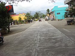 South Poblacion
 Dinadiawan white beach (a long stretch of clean, fine, golden white sand coastline)
 Rock formations along the shoreline (north of Baler along the Dicadi highway)
 Ampere Beach and Ampere Rock in Dipaculao


References
External links
Wikiwand - on
Seamless Wikipedia browsing. On steroids.
Remove ads