Top Qs
Timeline
Chat
Perspective
General Sánchez Cerro province
Province in Moquegua, Peru From Wikipedia, the free encyclopedia
Remove ads
General Sánchez Cerro is the smallest of three provinces in the Moquegua Region of Peru.[1][2] The capital of the province is Omate. The province was named after the former Peruvian army officer and president Luis Miguel Sánchez Cerro.
Remove ads
Boundaries
- North: Arequipa Region
- East: Puno Region
- South: province of Mariscal Nieto
- West: Arequipa Region
Geography
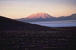
One of the highest peaks of the province is the Ubinas volcano. Other mountains are listed below:[3]
- Allqamarini
- Chuqipata
- Churi Wiqu
- Ch'allapata
- Ch'iyar Jaqhi
- Ch'unch'uni
- Hatun P'ukru
- Janq'u Saxa
- Jaqhi Jaqhini
- Jat'u K'achi
- Jichu Qullu
- Larama Quta
- Llallawa
- Llaqtayuq
- Kunturini
- Millu
- Minasniyuq
- Misiwa
- Pachakutiq (Arequipa-M.)
- Pachakutiq (Moquegua)
- Parwayuni
- Pirwa Tira
- Pirwani
- Puka Apachita
- Puka Saya
- Pukara
- Paqu Paquni
- Pura Purani
- P'aqu Urqu
- Qayqu
- Qillqata
- Qullpani
- Qhuyu Parwayuni
- Q'ulini
- Q'uwa Laki
- Rukutuni
- Suri Wasi
- Takuni
- Taruj Sallani
- Uturunqani (Ichuña)
- Uturunqani (Moquegua-Puno)
- Wallqani
- Wankarani
- Wari Pukara
- Wayllani
- Wila Qullu
- Wila Sirka
- Wila Wilani
- Wilani
- Wit'uni
- Yana Qaqa
- Yawri Salla
- Yuraq Urqu
Remove ads
Political division
The province is divided into eleven districts, which are:
Ethnic groups
The province is inhabited by indigenous citizens of Aymara and Quechua descent. Spanish, however, is the language which the majority of the population (60.36%) learnt to speak in childhood, 37.45% of the residents started speaking using the Quechua language and 1.98% using Aymara (2007 Peru Census).[4]
See also
References
Wikiwand - on
Seamless Wikipedia browsing. On steroids.
Remove ads


