Top Qs
Timeline
Chat
Perspective
Hengdong County
County in Hunan, People's Republic of China From Wikipedia, the free encyclopedia
Remove ads
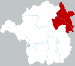
Hengdong County (simplified Chinese: 衡东县; traditional Chinese: 衡東縣; pinyin: Héngdōng Xiàn; lit. 'east of Mount Heng') is a county located in the east of Hengyang prefecture-level city, Hunan province, China. It was established from the eastern part of Hengshan County in 1966 and named after the east of Mount Heng. The county has an area of 1,926.78 km2 (743.93 sq mi) with a population of 746,300 (as of 2015). The county of Hengdong has two townships and 15 towns under its jurisdiction. Its seat is Mishui Town (洣水镇).[1]
Remove ads
Geography
Hengdong County is located in the south of Hunan Province, between the Hengyang Basin and the Yanqi Basin in the middle reaches of the Xiang River. It borders You County to the east, the counties of Anren and Hengnan to the south, counties of Hengshan and Hengnan to the west, and counties of Xiangtan and Zhuzhou to the north.
Hengdong is named after its location that the county is located in the east of Mount Heng. The county covers an area of 1,926.78 km2 (743.93 sq mi), the longest distance is 72.9 km (45.3 mi) from north to south and 53.6 km (33.3 mi) from west to east.
Remove ads
Subdivision
Climate
External links
References
Wikiwand - on
Seamless Wikipedia browsing. On steroids.
Remove ads


