Top Qs
Timeline
Chat
Perspective
Israelite Bay
Place in Western Australia From Wikipedia, the free encyclopedia
Remove ads
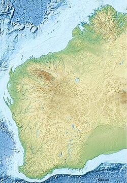
Israelite Bay is a bay and locality of the Shire of Esperance in the Goldfields-Esperance region of Western Australia, located along the Southern Ocean. Except for a small strip in the north-west of the locality, Israelite Bay is completely taken up by the Nuytsland Nature Reserve.[3][4]
Israelite Bay lies east of Esperance and the Cape Arid National Park, within the Nuytsland Nature Reserve and the Great Australian Bight.[5] Point Malcolm is about 25 kilometres (16 mi) west of Israelite Bay,[6] and there is a long sandy beach there.[7]
Climate data was recorded at Israelite Bay from 1885 to 1927, and it is frequently mentioned in Bureau of Meteorology weather reports as a geographical marker.[8]
It was the site of a significant telegraph station in the early 1900s.[9][10] It was also a location serviced by the state government's State Steamship Service, the South Coast Service, in the early 1900s.[11]
The Eastern Group, the eastern-most islands of the Recherche Archipelago, identified by Matthew Flinders in January 1802,[12] is offshore of Israelite Bay.[13]
Remove ads
References
Further reading
External links
Wikiwand - on
Seamless Wikipedia browsing. On steroids.
Remove ads

