Top Qs
Timeline
Chat
Perspective
Krishnarajanagara
Town in Karnataka, India From Wikipedia, the free encyclopedia
Remove ads
Krishnarajanagara is a town in Mysore district in the Indian state of Karnataka. It is also the administrative center of Krishnarajanagara Taluk.


Remove ads
Geography
Krishnarajanagara is located on the northern part of Mysore district, west of the Krishna Raja Sagara Reservoir. It has an average elevation of 786 metres above sea level.[1] NH-373, also known as SH-57 passes through the town of K.R.Nagara.
Climate
Krishnarajanagara has Tropical Savanna Climate under the Köppen climate classification. On average, the town receives the least amount of rainfall in January, and the most in October.

Remove ads
Demographics
According to the 2011 India census, Krishnarajanagara had a population of 35,805. Its gender ratio is relatively balanced, with 17,900 male residents and 17,905 female residents. Krishnarajanagara has an average literacy rate of 78.2%. with male literacy being 81.8%, and female literacy being 74.5%. In Krishnarajanagara, 9.9% of the population is under 6 years of age.[3]
Galleries
 Taluk boundary before creation of Saligrama Taluk
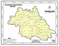 Taluk boundary same as Assembly Constituency as per 2011 Census before creation of Saligrama Taluk
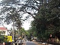 C.M. Road within the town
 Kandenahalli Bridge on the northeast of the town
_2011.jpg)
_Vidhana_Sabha_Constituency.jpg)


See also
- Saligrama, Mysore
- Hosa Agrahara
References
Wikiwand - on
Seamless Wikipedia browsing. On steroids.
Remove ads