Top Qs
Timeline
Chat
Perspective
Khlong San district
Khet in Bangkok, Thailand From Wikipedia, the free encyclopedia

Remove ads
Khlong San (Thai: คลองสาน, pronounced [kʰlɔ̄ːŋ sǎːn]) is one of the 50 districts (khet) of Bangkok, Thailand. On the west bank of Chao Phraya River, its neighboring districts across the river are (from north clockwise) Phra Nakhon, Samphanthawong, Bang Rak, Sathon, and Bang Kho Laem. On the west side of the river, the only land neighbor is Thon Buri district.

Remove ads
History
Summarize
Perspective
Maeklong Railway | ||||||||||||||||||||||||||||||||||||||||||||||||||||||||||||||||||||||||||||||||||||||||||||||||||||||||||||||||||||||||||||||||||||||||||||||||||||||||||||||||||||||||||||||||||||||||||||||||||||||||||||||||||||||||||||||||||||||||||||||||||||||||||||||||||||||||||
|---|---|---|---|---|---|---|---|---|---|---|---|---|---|---|---|---|---|---|---|---|---|---|---|---|---|---|---|---|---|---|---|---|---|---|---|---|---|---|---|---|---|---|---|---|---|---|---|---|---|---|---|---|---|---|---|---|---|---|---|---|---|---|---|---|---|---|---|---|---|---|---|---|---|---|---|---|---|---|---|---|---|---|---|---|---|---|---|---|---|---|---|---|---|---|---|---|---|---|---|---|---|---|---|---|---|---|---|---|---|---|---|---|---|---|---|---|---|---|---|---|---|---|---|---|---|---|---|---|---|---|---|---|---|---|---|---|---|---|---|---|---|---|---|---|---|---|---|---|---|---|---|---|---|---|---|---|---|---|---|---|---|---|---|---|---|---|---|---|---|---|---|---|---|---|---|---|---|---|---|---|---|---|---|---|---|---|---|---|---|---|---|---|---|---|---|---|---|---|---|---|---|---|---|---|---|---|---|---|---|---|---|---|---|---|---|---|---|---|---|---|---|---|---|---|---|---|---|---|---|---|---|---|---|---|---|---|---|---|---|---|---|---|---|---|---|---|---|---|---|---|---|---|---|---|---|---|---|---|---|---|---|---|---|---|---|---|
| ||||||||||||||||||||||||||||||||||||||||||||||||||||||||||||||||||||||||||||||||||||||||||||||||||||||||||||||||||||||||||||||||||||||||||||||||||||||||||||||||||||||||||||||||||||||||||||||||||||||||||||||||||||||||||||||||||||||||||||||||||||||||||||||||||||||||||
Khlong San is one of the oldest districts of Bangkok with a long history. Its name comes from a khlong (คลอง; lit: canal) that runs through the area, called "Khlong San" or "Khlong Prasan". It starts from the Chao Phraya River and flows toward Khlong Somdet Chao Phraya Ong Noi in front of Wat Phichai Yat, connecting with several other canals such as Khlong Wat Thong Thammachat, Khlong Wat Thong Nopphakhun, and Khlong Lat Ya. All of these were waterways passing through the local orchards. The most famous fruit of Khlong San was longkong (a type of langsat). Around 70 to 80 years ago, many of the canals were excavated and replaced by roads such as Lat Ya, Prajadhipok, and Khlong San Roads; now known collectively as Somdet Chao Phraya Road.[2]
Khlong San was called, in chronological order, Amphoe Bang Lamphu Lang (บางลำภูล่าง), Amphoe Buppharam (บุปผาราม), and Amphoe Khlong San (since 1916) when it was part of Thonburi Province. Its status was changed to king amphoe in 1938 and back to amphoe again in 1957 due to population changes. It became part of Bangkok after the merging of Thonburi and Phra Nakhon Provinces in 1971.
Khlong San was originally the terminus of the Maeklong Railway, but the line was cut back to Wongwian Yai in 1961 to ease traffic congestion.[3]
Remove ads
Administration
The district is divided into four sub-districts (khwaeng).

Places

- King Taksin Monument and Wongwian Yai (วงเวียนใหญ่)
- Wat Anongkharam (วัดอนงคาราม)
- Wat Sawettachat (วัดเศวตฉัตร)
- Wat Phichai Yat (วัดพิชัยญาติ)
- Wat Thong Thammachat (วัดทองธรรมชาติ)
- Wat Thong Nopphakhun (วัดทองนพคุณ)
- PLATF@RM (แพลตฟอร์ม)
- Princess Mother Memorial Park (อุทยานสมเด็จพระศรีนครินทร์) and Thang Nguan Hah Vintage House (เก๋งจีนทั้งง่วนฮะ) with Guan Yu Shrine (ศาลเจ้ากวนอู)
- Wang Li House (บ้านหวั่งหลี) and Lhong 1919 (ล้ง 1919) with Mazu Shrine (ศาลเจ้าแม่ทับทิมคลองสาน)
- Tha Din Daeng (ท่าดินแดง)
- Pong Patchamit Fort (ป้อมป้องปัจจามิตร)
- ICONSIAM (ไอคอนสยาม)
- Sinn Sathorn Tower (สินสาธรทาวเวอร์)
- Saichol Mansion (Residential Tower)
Transportation
- Wongwian Yai is a major bus hub on the west side of the Chao Phraya River.
- The district is served by stations on two rapid transit lines:
- Silom Line: Krung Thon Buri BTS station and Wongwian Yai BTS station
- Gold Line (Bangkok): Krung Thon Buri BTS station, Charoen Nakorn station and Khlong San station
Health
- Taksin Hospital, Bangkok Metropolitan Administration
- Somdet Chaopraya Institute of Psychiatry, Department of Mental Health, Ministry of Public Health
Notable people
- Srinagarindra – mother of King Ananda Mahidol (Rama VIII) and King Bhumibol Adulyadej (Rama IX)
Gallery
 Mae ka (แม่ค้า; female trader in Thai) is cooking Khanom buang at Tha Din Daeng
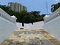 Pong Patchamit Fort
 Inside Princess Mother Memorial Park
 Lat Ya Road sign
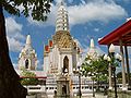
 Krung Thon Buri Road from Krung Thon Buri BTS Station
 Wongwian Yai BTS Station
 Pagoda, Chee Chin Khor Foundation, a historic Chinese temple
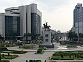 King Taksin Monument at Wongwian Yai, the left background is Khlong San
 Wongwian Yai at night as seen from Khlong San area

.jpg)


.jpg)
Remove ads
References
External links
Wikiwand - on
Seamless Wikipedia browsing. On steroids.
Remove ads