Top Qs
Timeline
Chat
Perspective
Khunjerab Pass
Mountain pass in Pakistan and China From Wikipedia, the free encyclopedia

Remove ads
Khunjerab Pass (Chinese: 红其拉甫口岸; Urdu: درہ خنجراب ⓘ; Uyghur: قونجىراپ ئېغىزى) is a mountain pass in northern Pakistan that lies at an elevation of 4,693 metres (15,397 ft) above sea level. It is located in the Karakoram and holds a significant strategic position on the northern border of Pakistan, specifically in the Gilgit-Baltistan's Hunza and Nagar Districts. Additionally, it is positioned on the southwestern border of China, within the Xinjiang region.


Near Khunjerab Pass, there is another pass known as Mutsjliga Pass, which stands at an elevation of 5,314 metres (17,434 ft) and is located at approximately 36.97374°N 75.2973°E.
Remove ads
Etymology
The word "خنجراب" in the local Wakhi language means 'waterfall house'. It is derived from two words, "خون"-"Khun" means house and "جراب"-"Jerab" means a creek coming from a spring or a waterfall.
Notability
Summarize
Perspective

The Khunjerab Pass holds several distinctions, including being the highest paved international border crossing globally and serving as the highest point along the Karakoram Highway. The construction of the road across this pass was completed in 1982, and it has since supplanted the previously unpaved Mintaka and Kilik passes as the principal route across the formidable Karakoram Range.
The decision to use the Khunjerab Pass for the Karakoram Highway was made in 1966. China citing the fact that Mintaka would be more susceptible to air strikes, recommended the steeper Khunjerab Pass instead.[1]
On the Pakistani-administered side, the pass is 42 km (26 mi) from the National Park station and checkpoint in Dih, 75 km (47 mi) from the customs and immigration post in Sost, 270 km (170 mi) from Gilgit, and 870 km (540 mi) from Islamabad.
On the Chinese side, the pass is the southwest terminus of China National Highway 314 (G314) and is 130 km (81 mi) from Tashkurgan, 420 km (260 mi) from Kashgar and 1,890 km (1,170 mi) from Urumqi. The Chinese port of entry is located 3.5 km (2.2 mi) along the road from the pass in Tashkurgan County.
The long, relatively flat pass is often snow-covered[2] during the winter season and as a consequence is generally closed for heavy vehicles from November 30 to May 1 and for all vehicles from December 30 to April 1.[3] This is not set however, late snowfall in the region attributed to climate-change means the road is accessible even during the winter months. Depending on the amount of snowfall, the road is cleared from time periods ranging from days to weeks.
Since June 1, 2006, there has been a daily bus service across the boundary from Gilgit to Kashgar, Xinjiang.[4]

This is one of the international borders where left-hand traffic (Pakistan-administered Gilgit-Baltistan) changes to right-hand traffic (China) and vice versa.
Highest ATM in the world
The Pakistani side features the highest ATM in the world, administered by the National Bank of Pakistan and linked to China UnionPay and the domestic 1LINK switch.[5]
Remove ads
Railway
In 2007, consultants[6] were hired to evaluate the construction of a railway through this pass to connect China with transport in Pakistan's Gilgit-Baltistan. A feasibility study started in November 2009 for a line connecting Havelian 750 km (466 mi), away Khyber Pakhtunkhwa, and Kashgar 350 km (217 mi) away in Xinjiang.[7] However, no progress has been made thereafter and this project is also not part of the current CPEC plan.
Gallery
 Khunjerab Pass, border crossing between China and Pakistan
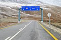 Khunjerab Pass Road
 Chinese and Pakistani soldiers at Khunjerab Pass
 China–Pakistan friendship monument in Attabad, about 150 km from the border


_near_Beautiful_Tunnels_at_atabad_lake_Hunza_Valley.jpg)
See also
References
External links
Wikiwand - on
Seamless Wikipedia browsing. On steroids.
Remove ads