Top Qs
Timeline
Chat
Perspective
Kolozs County
County of the Kingdom of Hungary From Wikipedia, the free encyclopedia
Remove ads
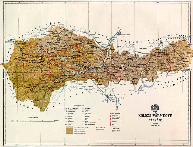
Kolozs County was an administrative county (comitatus) of the Kingdom of Hungary, of the Eastern Hungarian Kingdom and of the Principality of Transylvania. Its territory is now in north-western Romania (north-western Transylvania). The capital of the county was Kolozsvár (present-day Cluj-Napoca).
This article needs additional citations for verification. (June 2012) |
Remove ads
Geography

After 1876, Kolozs County shared borders with the Hungarian counties Bihar, Szilágy, Szolnok-Doboka, Beszterce-Naszód, Maros-Torda, and Torda-Aranyos. The rivers Crișul Repede and Someșul Mic flowed through the county. Its area was 5,006 km2 (1,933 sq mi) in 1910.
Remove ads
History
Kolozs County was formed in the 11th century. In 1876, when the administrative structure of Transylvania was changed, the territory of Kolozs was modified and some villages of Doboka County (which was then disbanded) were annexed to it. In 1920, by the Treaty of Trianon, the county became part of Romania. Following the Second Vienna Award, large part of it was retaken by Hungary in 1940 and the county was recreated; however, after World War II it became part of Romania again. Most of the territory of the county lies in the present Romanian county Cluj, some parts of the county are in the present Romanian counties Sălaj (north-west), Bistrița-Năsăud (north-east), and Mureș (south-east).
Remove ads
Demographics

Subdivisions

In the early 20th century, the subdivisions of Kolozs County were:
Remove ads
Notes
References
Wikiwand - on
Seamless Wikipedia browsing. On steroids.
Remove ads


