Top Qs
Timeline
Chat
Perspective
Helena-Lewis and Clark National Forest
Forest in Montana, United States From Wikipedia, the free encyclopedia
Remove ads
Helena-Lewis and Clark National Forest is located in west-central Montana, United States. Spanning 2.8-million acres[3]. The region was inhabited by various cultures of Native Americans for a period of at least 8,000–10,000 years. When the Lewis and Clark Expedition came to this area, different areas of the large forest territory were used by members of the Blackfeet, Sioux, Cheyenne, Flathead and Crow nations for hunting and as an area for their seasonal winter camps. The forests provided shelter from the winter.
This article includes a list of general references, but it lacks sufficient corresponding inline citations. (August 2025) |

The forest lands were defined and established by the federal government in 1897, following its Treaty of 1896 with the Blackfeet forced to cede lands and move to a reservation adjacent to the national forest. The forest is one of the oldest forest preserves in the U.S. The forest is named in honor of the members of the Lewis and Clark Expedition, which passed through the forest between 1804 and 1806 while exploring the Louisiana Purchase for President Thomas Jefferson.
The forest is managed as two separate zones. The eastern sections, under the Jefferson Division, is a mixture of grass and shrublands dotted with island pockets of forested areas. Cattle leases to local ranchers as well as timber harvesting are the norm. The western Rocky Mountain Division, which straddles the Continental divide, is managed chiefly for environmental preservation, as much of the land has been designated as wilderness. Forest headquarters are located in Great Falls, Montana. Local ranger district offices have been established in Choteau, Harlowton, Neihart, Stanford, and White Sulphur Springs.[4]
The forest is broken into several separate sections. The eastern regions are dominated by the Big Belt Mountains, and are the location of the Gates of the Mountains Wilderness, which remains much as it did when the Lewis and Clark Expedition passed through the region. The western sections have both the continental divide and the Scapegoat Wilderness area, which is part of the Bob Marshall Wilderness complex. The southern region includes the Elkhorn Mountains. The forest is composed of a mixture of grass and sagebrush covered lowlands with "island" pockets of lodgepole pine and more mountainous areas where Douglas fir, spruce and larch can be found. The Rocky Mountains in the region do not exceed 10,000 feet (3,000 m).
Remove ads
Description
Summarize
Perspective

Altitudes range from 4,500 feet (1,400 m) to the top of Rocky Mountain Peak at 9,362 feet (2,900 m). The forest is divided into seven separate sections and encompasses eight mountain ranges; the Judith, Big Snowy, Little Snowy, Crazy, Castle, Little Belt and Highwood Mountains. The westernmost section includes portions of the Scapegoat and the Bob Marshall wildernesses, and borders Glacier National Park to the north.
The western Rocky Mountain Division, informally called the Rocky Mountain Front, consists of a dense coniferous forest and has numerous species of spruce, fir, and pine. The Jefferson Division is dominated by ponderosa and lodgepole pine which prefer a drier climate. The grizzly bear and timber wolf are found in the western sections of the forest, and are especially dense in the designated wilderness areas.[5] In addition, the western section contains much of the wildlife present at the time of the Lewis and Clark Expedition through the region.[6] Mountain goats, bighorn sheep, elk, cougars, Canadian lynxes, wolverines and black bears are most common nearest the Continental Divide. In other sections of the forest, black bears, mule deer and white-tailed deer are the largest mammals found. Coyotes, raccoons, beavers, minks, muskrats, river otters and Columbian white-tailed deer inhabit the up-stream inlands. Throughout the forest, bald eagles, grouse, peregrine falcon and red tailed hawks are increasing in numbers. Lakes and streams are more numerous in the western section due to a higher altitude and more precipitation, and are home to the native westslope cutthroat trout. In the 1,600 miles (2,600 km) of rivers and streams in the forest, rainbow trout, brook trout and northern pike are relatively common. Excellent fly fishing opportunities are plentiful, especially in the Smith River.
The National Forest has 29 vehicle-accessible campgrounds. Two ski areas also operate within the forest. Almost 1,500 miles (2,400 km) of hiking trails provide access to remote locations in the seven different mountain ranges within the Forest. Solitude is most common in the Crazy Mountains and in the wilderness areas near the Continental divide. Summertime average high temperatures are in the 70s °F (20s °C), but the winter can be very cold, especially in the more exposed eastern sections. Snow can linger for up to 10 months of the year along the Continental divide.
The forest lies in parts of thirteen counties. In descending order of land area, they are Lewis and Clark, Meagher, Judith Basin, Teton, Cascade, Pondera, Fergus, Wheatland, Chouteau, Glacier, Golden Valley, Sweet Grass, and Park counties.[7]
The grizzly bear has a sustained population in the northwestern section of the forest,[8] especially in the Scapegoat Wilderness. Other predators such as wolves, bobcats, wolverines, mountain lions, and Canadian lynx are also present[9] Black bears are numerous as are elk, moose, mule deer, and antelope. There are also small populations of bighorn sheep and mountain goats. Along streams and lakes, sightings of nesting bald eagles and other raptors are becoming more common due to protection of these species and their vitally important waterways.

Seven hundred miles (1,100 km)of hiking trails are located in the forest along with numerous trout streams and several lakes. There are over a dozen improved campgrounds. Snowmobile use is common in the winter months as is cross-country skiing.
Interstate 15 runs north–south and U.S. Route 12 runs east–west through the area. The largest nearby city is Helena, Montana, which is the headquarters location for the forest.
The forest was the site of the 1949 Mann Gulch fire, which claimed the lives of 13 firefighters and which was the subject of both Norman Maclean's book Young Men and Fire and James Keelaghan's folk song "Cold Missouri Waters."

In descending order of land area the forest is located in parts of Lewis and Clark, Broadwater, Powell, Jefferson, and Meagher counties.[10] There are local ranger district offices in Helena, Lincoln, and Townsend.[11]
Remove ads
History
Summarize
Perspective
In the late 19th century, after the end of the Indian Wars, the federal government worked to move Native American tribes on to Indian reservations, requiring them to cede land and extinguish their land claims to large areas of territory. The United States wanted to open the West to settlement and development by European Americans. The Blackfeet Indian Reservation, with members mostly of the Piegan Blackfeet branch, was established by Treaty of 1896 to the east of this forest area and Glacier National Park, bordering the province of Alberta, Canada, to the north.
The forest was established on February 22, 1897, as the Lewis and Clarke Forest Reserve under the management of the United States General Land Office. On June 9, 1903, the Flathead Forest Reserve was added, and on March 2, 1907, the spelling was changed to Lewis and Clark, and land was added. The forest territory had been transferred to the U.S. Forest Service in 1906, and was designated by the government as a National Forest.
On April 8, 1932 the entire Jefferson National Forest was added, which itself comprised the former Little Belt, Crazy Mountain, Snowy Mountains, Little Rockies and Highwood Mountains National Forests. Finally, on July 1, 1945, part of Absaroka National Forest was added as the last portion of this forest.[12] The Helena and Lewis and Clark National forests consolidated their administrations in 2014.
The Alice Creek Fire was started by a lightning strike in July 2017. The fire burned at least 29,252 acres (118 km2), crossed the Continental Divide, and impacted aquatic life.[13]
Remove ads
Badger-Two Medicine
Summarize
Perspective
The Badger-Two Medicine area is a 200 square miles (520 km2) portion of the Lewis and Clark Forest that is adjacent to the Blackfeet Reservation and Glacier National Park. It is sacred ground for the Blackfeet tribe. The Treaty of 1896 gives Blackfeet tribal members the right to hunt and fish the area in accordance with state law and to cut wood for domestic use.[14] The Blackfeet have battled to protect Badger-Two Medicine by keeping the area roadless and by fighting proposed oil and gas drilling all along the Front, which is managed largely by the U.S. Forest Service (USFS) and the Bureau of Land Management (BLM).[15] The Blackfeet have been assisted by conservation groups, preservationists (including the National Trust for Historic Preservation), outdoor sportsmen, ranchers and business owners.[16][17]
Approximately 93,000 acres (38,000 ha) are currently recognized as eligible for the National Register of Historic Places (NRHP) as a traditional cultural district (TCD), but proponents continue to lobby to have the entire Badger-Two Medicine area recognized as an eligible TCD.[16]
The U.S. Forest Service banned motorized travel on 186 miles (299 km) of trails in 2009.[18] In January 2011, a federal district judge cleared the roadblock on the U.S. Forest Service's Badger-Two Medicine travel plan. The plan allows motorized access on 8 miles (13 km) of established trails and bans all snowmobile travel.[19][16]
Gallery
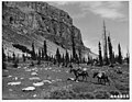 A rider near the Chinese Wall in 1946
 A rainbow on Ear Mountain near Choteau, Montana
 Judith Station, c. 1920
 The Chinese Wall in the Rocky Mountain Ranger District
 Crow Creek Falls is in the Elkhorn Mountains section of the Helena National Forest

.jpg)
,_Lewis_and_Clark_National_Forest,_Judith_Ranger_District,_west_of_Utica,_Montana.jpg)
.jpg)

See also
References
Wikiwand - on
Seamless Wikipedia browsing. On steroids.
Remove ads