Top Qs
Timeline
Chat
Perspective
List of municipalities in Connecticut
From Wikipedia, the free encyclopedia

Remove ads
The U.S. state of Connecticut is divided into 169 municipalities, including 19 cities, 149 towns and one borough, which are grouped into eight historical counties, as well as nine planning regions which serve as county equivalents.
Quick facts Municipalities of Connecticut, Location ...
| Municipalities of Connecticut | |
|---|---|
Towns (light grey) and cities (dark grey) of Connecticut | |
| Location | State of Connecticut |
| Number | 169 |
| Populations | 785 (Union) – 148,654 (Bridgeport) |
| Areas | 4.98 square miles (12.9 km2) (Derby) – 61.59 square miles (159.5 km2) (New Milford) |
| Government | |
Close
Towns traditionally have a town meeting form of government; under the Home Rule Act, however, towns are free to choose their own government structure. Nineteen of the towns in Connecticut are consolidated city-towns, and one (Naugatuck) is a consolidated borough-town.
City incorporation requires a Special Act by the Connecticut General Assembly. All cities in Connecticut are dependent municipalities, meaning they are located within and subordinate to a town. However, except for one, all currently existing cities in Connecticut are consolidated with their parent town. Former inner-cities are listed in a separate table below.
Towns in Connecticut are allowed to adopt a city form of government without the need to re-incorporate as an inner-city. Connecticut state law also makes no distinction between a consolidated town/city and a regular town. Bolded city names indicate the state's largest cities, with the most populated being Bridgeport. Currently, Tolland County and Windham County are the only counties in Connecticut without a single city in them.
Remove ads
List of municipalities in Connecticut
Main article: Local government in Connecticut
More information Name, Designation ...
Close
Remove ads
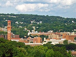
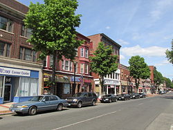
Cities
Summarize
Perspective
Note: There are currently 21 cities in Connecticut and those with a population greater than 100,000 are listed in bold.
More information City, County ...
Close
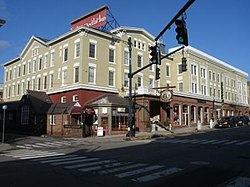
Former cities
More information Former city, County ...
| Former city | County | Planning region | Date chartered as city | Date of disestablishment | Disposition |
|---|---|---|---|---|---|
| South Norwalk | Fairfield | Western Connecticut | 1871 | 1913 | Consolidated with Town and City of Norwalk in 1913.
Now a neighborhood and a taxing district |
| Rockville | Tolland | Capitol | 1889 | 1965 | Consolidated with the Town of Vernon. Now a CDP. |
| Willimantic | Windham | Southeastern Connecticut | 1893 | 1983 | Now a CDP in the town of Windham |
| Putnam | Windham | Northeastern Connecticut | 1895 | 1984 | Now a CDP in the town of Putnam |
Close
Gallery
- Connecticut cities


Remove ads
Boroughs
More information Name, Parent town ...
| Name | Parent town | Population (2020) |
Area (2020) | Coordinates | |
|---|---|---|---|---|---|
| sq mi | km2 | ||||
| Bantam | Litchfield | 720 | 1.01 | 2.6 | 41°43′24″N 73°14′26″W |
| Danielson | Killingly | 4,155 | 1.16 | 3.0 | 41°48′29″N 71°53′03″W |
| Fenwick | Old Saybrook | 53 | 0.39 | 1.0 | 41°16′12″N 72°21′26″W |
| Groton Long Point | Groton | 530 | 0.4 | 1.0 | 41°18′52″N 72°00′28″W |
| Jewett City | Griswold | 3,328 | 0.74 | 1.9 | 41°36′26″N 71°58′47″W |
| Litchfield | Litchfield | 1,179 | 1.37 | 3.5 | 41°44′51″N 73°11′17″W |
| Naugatuck[a] | 31,519 | 16.39 | 42.4 | 41°29′23″N 73°03′05″W | |
| Newtown | Newtown | 1,914 | 2.3 | 6.0 | 41°24′42.82″N 73°18′43.01″W |
| Stonington | Stonington | 976 | 0.7 | 1.8 | 41°20′5.15″N 71°53′58.05″W |
| Woodmont | Milford | 1,486 | 0.99 | 2.6 | 41°13′41″N 72°59′32″W |
Close
See also
Notes
References
External links
Wikiwand - on
Seamless Wikipedia browsing. On steroids.
Remove ads
Remove ads