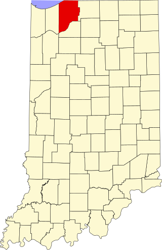
[ 3] Name on the Register[ 4]
Image
Date listed[ 5]
Location
City or town
Description
1 Ames Family Homestead Ames Family Homestead December 19, 2012 (# 12001062 5332 and 5336 W150N, northwest of LaPorte 41°37′36″N 86°48′12″W Center Township
2 Barker House Barker House December 7, 2001 (# 01001349 444 Barker Rd. 41°41′17″N 86°52′59″W Michigan City Save the Dunes offices and Barker Woods Nature Preserve (managed by Shirley Heinze Land Trust )
3 John H. Barker Mansion John H. Barker Mansion October 10, 1975 (# 75000027 631 Washington St. 41°42′53″N 86°54′09″W Michigan City Michigan City Civic Center
4 John and Isabel Burnham House John and Isabel Burnham House August 1, 2013 (# 13000085 2602 Lake Shore Dr. 41°44′56″N 86°50′58″W Long Beach
5 Cedar Lodge Upload image March 3, 2025 (# 100011478 706 West 11th Street 41°35′52″N 86°43′36″W Cedar Lodge, ca. 1915 Craftsman home designed by George Wood Allen for Dr. H. H. Martin.
6 Downtown LaPorte Historic District Downtown LaPorte Historic District September 15, 1983 (# 83000039 Roughly bounded by State, Jackson, Maple, and Chicago Sts. 41°36′41″N 86°43′20″W LaPorte
7 Elston Grove Historic District Elston Grove Historic District September 25, 2013 (# 13000759 Bounded by Michigan Boulevard and 11th, Pine, and 6th Sts. 41°42′49″N 86°53′35″W Michigan City
8 First Congregational Church of Michigan City First Congregational Church of Michigan City December 7, 2001 (# 01001343 531 Washington St. 41°42′57″N 86°54′11″W Michigan City
9 James and Lavinia Forrester Farmstead James and Lavinia Forrester Farmstead June 12, 2017 (# 100001060 969 Forrester Rd. 41°35′33″N 86°48′41″W Scipio Township
10 Franklin Street Commercial Historic District Franklin Street Commercial Historic District December 31, 2013 (# 13001013 Bounded by Pine, 4th, and 11th Sts., and the alley between Franklin and Washington Sts. 41°42′51″N 86°54′01″W Michigan City
11 Dr. Robert and Amelia Frost House Upload image August 21, 2020 (# 100005503 3215 Cleveland Ave. 41°41′25″N 86°53′03″W Michigan City
12 Garrettson-Baine-Bartholomew House Garrettson-Baine-Bartholomew House December 7, 2001 (# 01001340 2921 Franklin St. 41°41′51″N 86°53′41″W Michigan City
13 John and Cynthia Garwood Farmstead John and Cynthia Garwood Farmstead June 15, 2012 (# 12000334 5600 Small Rd., west of LaPorte 41°36′40″N 86°48′31″W Center Township
14 Haskell and Barker Historic District Haskell and Barker Historic District September 30, 2014 (# 14000806 Washington and Wabash between 4th and Homer Sts. 41°42′38″N 86°54′04″W Michigan City
15 Hoover-Timme House Hoover-Timme House August 1, 2013 (# 13000086 2304 Hazeltine Dr. 41°44′42″N 86°51′19″W Long Beach
16 Indiana and Michigan Avenues Historic District Indiana and Michigan Avenues Historic District September 30, 2014 (# 14000807 Roughly Indiana and Michigan between Maple and Kingsbury Aves. 41°36′20″N 86°43′00″W La Porte
17 Lowell E. and Paula G. Jackson House Lowell E. and Paula G. Jackson House August 1, 2013 (# 13000087 2935 Ridge Rd. 41°45′07″N 86°50′24″W Long Beach
18 George and Adele Jaworowski House George and Adele Jaworowski House August 1, 2013 (# 13000088 3501 Lake Shore Dr. in Duneland Beach 41°45′28″N 86°49′44″W Michigan Township
19 Long Beach School Long Beach School September 3, 2019 (# 100004366 2501 Oriole Trail 41°44′47″N 86°50′53″W Long Beach
20 Michigan City Breakwater Light Michigan City Breakwater Light July 24, 2017 (# 100001344 On breakwater in Lake Michigan , 0.5 miles northwest of the Michigan City harbor 41°43′47″N 86°54′51″W Michigan City
21 Michigan City East Pierhead Light Tower and Elevated Walk Michigan City East Pierhead Light Tower and Elevated Walk February 17, 1988 (# 88000069 Eastern side of the entrance to Michigan City Harbor 41°43′41″N 86°54′35″W Michigan City
22 Michigan City Lighthouse Michigan City Lighthouse November 5, 1974 (# 74000023 Washington Park 41°43′22″N 86°54′22″W Michigan City
23 Michigan City Post Office Michigan City Post Office June 15, 2000 (# 00000675 126 E. 5th St. 41°43′04″N 86°54′03″W Michigan City In 2010, the building was being used as a law office.
24 Francis H. Morrison House Francis H. Morrison House December 6, 1984 (# 84000492 1217 Michigan Ave. 41°36′24″N 86°43′00″W LaPorte
25 MUSKEGON Shipwreck SiteMUSKEGON Shipwreck SiteApril 26, 1989 (# 89000290 Address Restricted Michigan City
26 William Orr House William Orr House March 22, 1984 (# 84001063 4076 W. Small Rd., west of LaPorte 41°36′36″N 86°46′42″W Center Township
27 Pinehurst Hall Pinehurst Hall June 3, 1976 (# 76000027 3042 N. U.S. Route 35 , northwest of LaPorte 41°39′03″N 86°45′36″W Center Township
28 Pinhook Methodist Church and Cemetery Pinhook Methodist Church and Cemetery September 24, 2009 (# 09000759 8001 State Road 2 , northeast of Westville 41°33′48″N 86°51′28″W New Durham Township
29 Marion Ridgeway Polygonal Barn Marion Ridgeway Polygonal Barn May 27, 1993 (# 93000464 U.S. Route 35 north of its junction with Crescent Dr.41°35′25″N 86°42′09″W LaPorte
30 Scott-Rumley House Scott-Rumley House December 27, 2016 (# 16000905 211 Rose St. 41°36′44″N 86°42′51″W La Porte
31 Everel S. Smith House Everel S. Smith House December 12, 1990 (# 90001794 56 W. Jefferson St. 41°32′36″N 86°53′52″W Westville
32 Swedish Evangelical Lutheran Carmel Chapel and Carmel Cemetery Upload image May 24, 2021 (# 100006566 5901 West 50 South 41°36′00″N 86°49′20″W LaPorte vicinity
33 Tryon Farm Tryon Farm August 21, 2020 (# 100005515 1400 and 1402 Tryon Rd. 41°43′29″N 86°50′30″W Michigan City
34 Washington Park Washington Park June 26, 1991 (# 91000793 Roughly bounded by Lake Michigan, Krueger St., Trail Creek, Lakeshore Dr., Heisman Harbor Rd., and Browne Basin Rd. 41°43′34″N 86°54′03″W Michigan City
35 Wynkoop-Taylor-Swanson-Sharp Farmstead Wynkoop-Taylor-Swanson-Sharp Farmstead September 18, 2017 (# 100001607 3463 N. State Road 39 , north of LaPorte 41°39′31″N 86°44′17″W Center Township


