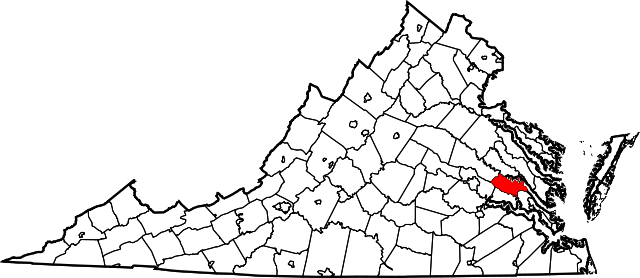
[ 3] Name on the Register[ 4]
Image
Date listed[ 5]
Location
City or town
Description
1 Cedar Grove Cedar Grove December 28, 1979 (# 79003058 Northwest of Providence Forge on Emmaus Church Rd. 37°29′06″N 77°06′55″W Providence Forge
2 Cedar Lane Cedar Lane May 8, 2017 (# 100000985 9040 State Route 249 37°31′47″N 77°02′32″W New Kent
3 Criss Cross Criss Cross May 11, 1973 (# 73002043 Southwest of New Kent off Criss Cross Rd. 37°30′10″N 77°01′47″W New Kent
4 Crump's Mill and Millpond Crump's Mill and Millpond September 24, 1999 (# 99001199 9065 Crump's Mill Rd. 37°32′24″N 77°05′22″W Quinton
5 Cumberland Cumberland May 8, 2017 (# 100000986 9007 Cumberland Rd. 37°32′23″N 76°58′39″W New Kent
6 Emmaus Baptist Church Emmaus Baptist Church June 10, 1993 (# 93000506 Western side of State Route 106 , 0.4 miles (0.64 km) south of Interstate 64 37°29′57″N 77°05′32″W Providence Forge
7 Foster's Castle Foster's Castle April 11, 1973 (# 73002044 Northeast of Tunstall off Old River Rd. 37°35′38″N 77°04′34″W Tunstall
8 Hampstead Hampstead December 18, 1970 (# 70000812 1 mile (1.6 km) northwest of the junction of Old Church and Steel Trap Rds. 37°36′25″N 77°07′43″W Tunstall
9 Marl Hill Marl Hill December 21, 1990 (# 90001832 St. Peters Ln., east of its junction with Old Church Rd. 37°32′23″N 77°03′03″W Talleysville
10 Moss Side Moss Side June 5, 2017 (# 100001046 8501 State Route 249 37°31′22″N 77°03′17″W New Kent
11 Moysonec Moysonec June 20, 1975 (# 75002026 Address Restricted Toano
12 New Kent Ordinary New Kent Ordinary December 9, 2019 (# 100004747 12000 State Route 249 37°31′05″N 76°58′43″W New Kent Court
13 New Kent School; George W. Watkins School New Kent School; George W. Watkins School August 7, 2001 (# 01001046 11825 State Route 249 (New Kent) and 6501 State Route 249 (Watkins) 37°31′46″N 77°05′54″W New Kent and Quinton Pair of schools that represent widespread token desegregation of southern schools in the decade after the 1954 Brown v. Board of Education U.S. Supreme Court decision. Focus of 1968 Green v. County School Board
14 Olivet Presbyterian Church Olivet Presbyterian Church January 26, 1978 (# 78003034 2.7 miles (4.3 km) northwest of Providence Forge on Olivet Church Rd. 37°28′49″N 77°03′48″W Providence Forge
15 Shuttlewood Upload image August 16, 2022 (# 100008021 8830 Saint Peters Ln. 37°32′30″N 77°02′31″W New Kent vicinity
16 South Garden South Garden November 10, 2022 (# 100008391 6331 Pocahontas Trail 37°27′44″N 77°06′08″W Providence Forge
17 Spring Hill Spring Hill November 27, 2002 (# 02001448 11221 Carriage Rd. 37°26′05″N 76°59′44″W Providence Forge
18 St. Peter's Church St. Peter's Church October 1, 1969 (# 69000263 St. Peters Ln. 37°32′26″N 77°03′23″W New Kent designated a National Historic Landmark March 2, 2012 (as St. Peter's Parish Church)


