Top Qs
Timeline
Chat
Perspective
Quigley's Point
Village in County Donegal, Ireland From Wikipedia, the free encyclopedia
Remove ads
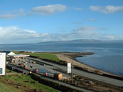
Quigley's Point (Irish: Rinn Uí Choigligh)[2] is a village in County Donegal, Ireland. Located on the eastern shores of Inishowen and overlooking Lough Foyle, the village is sometimes known locally as "Carrowkeel" (or "Carowkeel") as it is in a townland of that name.[3] To the south is the city of Derry and to the north lie the villages of Moville and Greencastle. A car ferry links Greencastle with Magilligan during the summer. The river Cabry, which flows through the area,[4] is spanned by a late-18th century bridge at Quigley's Point.[5]
Evidence of ancient settlement in the area includes a standing stone site in Cabry townland, and a reputed former cromlech site (since removed) in Carrowkeel townland.[6]
The Presbyterian Church in Ireland has a church at Greenbank near the village. Greenbank Presbyterian Church was built in 1862 in a "Gothic influenced" style.[7] The nearby Presbyterian church hall, which was gutted by fire following an apparent arson attack in 2003,[8][9] was subsequently restored.[10]
Quigley's Point had a population of 213 people at the time of the 2022 census, down slightly from 227 in the 2011 census.[11]
Remove ads
See also
References
Wikiwand - on
Seamless Wikipedia browsing. On steroids.
Remove ads


