The town of Saint-Pierre is at the beginning of the only major road N3 across the island. From here, the road leads to Le Tampon, La Plaine des Cafres and Bourg Murat. From that area, there is a relatively easy access to the Piton de la Fournaise and a starting point of many excursions.
Climate
Saint-Pierre has a hot semi-arid climate (Köppen climate classification BSh), while Ligne Paradis and Ravine des Cabris's climate type has tropical savanna climate (Köppen climate classification Aw) in the southeast of the area. The average annual temperature in Saint-Pierre (downtown) is 24.1 °C (75.4 °F). The average annual rainfall is 672.1 mm (26.46 in) with February as the wettest month. The temperatures are highest on average in January, at around 27.3 °C (81.1 °F), and lowest in July, at around 20.9 °C (69.6 °F). The highest temperature ever recorded in Saint-Pierre (downtown) was 35.7 °C (96.3 °F) on 20 February 2007; the coldest temperature ever recorded was 12.6 °C (54.7 °F) on 15 September 2020.
More information Climate data for Saint-Pierre (downtown, altitude 61m, 1991–2020 normals, extremes 1997−present), Month ...
| Climate data for Saint-Pierre (downtown, altitude 61m, 1991–2020 normals, extremes 1997−present) |
| Month |
Jan |
Feb |
Mar |
Apr |
May |
Jun |
Jul |
Aug |
Sep |
Oct |
Nov |
Dec |
Year |
| Record high °C (°F) |
35.6
(96.1) |
35.7
(96.3) |
34.5
(94.1) |
33.2
(91.8) |
32.0
(89.6) |
30.5
(86.9) |
31.5
(88.7) |
29.4
(84.9) |
30.7
(87.3) |
31.7
(89.1) |
32.8
(91.0) |
34.9
(94.8) |
35.7
(96.3) |
| Mean daily maximum °C (°F) |
31.6
(88.9) |
31.6
(88.9) |
31.1
(88.0) |
29.9
(85.8) |
28.2
(82.8) |
26.5
(79.7) |
25.6
(78.1) |
26.0
(78.8) |
26.8
(80.2) |
28.0
(82.4) |
29.5
(85.1) |
30.9
(87.6) |
28.8
(83.8) |
| Daily mean °C (°F) |
27.1
(80.8) |
27.1
(80.8) |
26.5
(79.7) |
25.3
(77.5) |
23.6
(74.5) |
21.8
(71.2) |
20.9
(69.6) |
21.0
(69.8) |
21.7
(71.1) |
23.0
(73.4) |
24.5
(76.1) |
26.1
(79.0) |
24.1
(75.4) |
| Mean daily minimum °C (°F) |
22.5
(72.5) |
22.6
(72.7) |
21.9
(71.4) |
20.7
(69.3) |
19.0
(66.2) |
17.1
(62.8) |
16.2
(61.2) |
16.0
(60.8) |
16.6
(61.9) |
18.0
(64.4) |
19.6
(67.3) |
21.3
(70.3) |
19.3
(66.7) |
| Record low °C (°F) |
18.4
(65.1) |
17.6
(63.7) |
17.8
(64.0) |
16.6
(61.9) |
14.7
(58.5) |
13.4
(56.1) |
13.1
(55.6) |
12.9
(55.2) |
12.6
(54.7) |
14.5
(58.1) |
15.7
(60.3) |
17.1
(62.8) |
12.6
(54.7) |
| Average precipitation mm (inches) |
108.7
(4.28) |
116.1
(4.57) |
97.2
(3.83) |
74.8
(2.94) |
47.7
(1.88) |
49.5
(1.95) |
53.4
(2.10) |
25.6
(1.01) |
20.5
(0.81) |
17.3
(0.68) |
30.9
(1.22) |
53.0
(2.09) |
694.7
(27.35) |
| Average precipitation days (≥ 1.0 mm) |
7.1 |
8.3 |
8.0 |
6.7 |
5.5 |
6.2 |
6.1 |
3.7 |
2.8 |
2.5 |
2.6 |
4.4 |
63.9 |
| Source: Météo France[3] |
Close
More information Climate data for Saint-Pierre (Pierrefonds Airport, altitude 21m, 1991–2020 normals, extremes 1999–present), Month ...
| Climate data for Saint-Pierre (Pierrefonds Airport, altitude 21m, 1991–2020 normals, extremes 1999–present) |
| Month |
Jan |
Feb |
Mar |
Apr |
May |
Jun |
Jul |
Aug |
Sep |
Oct |
Nov |
Dec |
Year |
| Record high °C (°F) |
35.8
(96.4) |
35.1
(95.2) |
34.8
(94.6) |
33.1
(91.6) |
32.0
(89.6) |
29.9
(85.8) |
30.5
(86.9) |
28.6
(83.5) |
28.6
(83.5) |
30.6
(87.1) |
32.1
(89.8) |
33.8
(92.8) |
35.8
(96.4) |
| Mean daily maximum °C (°F) |
31.3
(88.3) |
31.1
(88.0) |
30.7
(87.3) |
29.6
(85.3) |
27.9
(82.2) |
26.3
(79.3) |
25.3
(77.5) |
25.6
(78.1) |
26.3
(79.3) |
27.7
(81.9) |
29.0
(84.2) |
30.5
(86.9) |
28.4
(83.1) |
| Daily mean °C (°F) |
27.5
(81.5) |
27.5
(81.5) |
27.0
(80.6) |
25.9
(78.6) |
24.2
(75.6) |
22.5
(72.5) |
21.5
(70.7) |
21.6
(70.9) |
22.3
(72.1) |
23.6
(74.5) |
25.0
(77.0) |
26.7
(80.1) |
24.6
(76.3) |
| Mean daily minimum °C (°F) |
23.8
(74.8) |
23.8
(74.8) |
23.3
(73.9) |
22.1
(71.8) |
20.5
(68.9) |
18.7
(65.7) |
17.7
(63.9) |
17.6
(63.7) |
18.2
(64.8) |
19.5
(67.1) |
21.0
(69.8) |
22.8
(73.0) |
20.8
(69.4) |
| Record low °C (°F) |
20.4
(68.7) |
20.1
(68.2) |
20.2
(68.4) |
18.7
(65.7) |
15.7
(60.3) |
14.6
(58.3) |
14.2
(57.6) |
13.8
(56.8) |
14.7
(58.5) |
15.1
(59.2) |
16.5
(61.7) |
18.8
(65.8) |
13.8
(56.8) |
| Average precipitation mm (inches) |
100.5
(3.96) |
110.3
(4.34) |
95.9
(3.78) |
72.9
(2.87) |
44.2
(1.74) |
49.8
(1.96) |
50.2
(1.98) |
27.6
(1.09) |
19.5
(0.77) |
17.8
(0.70) |
28.8
(1.13) |
45.9
(1.81) |
663.4
(26.12) |
| Average precipitation days (≥ 1.0 mm) |
6.7 |
7.8 |
7.4 |
6.6 |
5.2 |
6.2 |
6.3 |
3.7 |
2.7 |
2.5 |
2.2 |
4.1 |
61.4 |
| Source: Météo France[4] |
Close
More information Climate data for Saint-Pierre (Ligne Paradis, altitude 156m, 1991–2020 normals, extremes 1966–present), Month ...
| Climate data for Saint-Pierre (Ligne Paradis, altitude 156m, 1991–2020 normals, extremes 1966–present) |
| Month |
Jan |
Feb |
Mar |
Apr |
May |
Jun |
Jul |
Aug |
Sep |
Oct |
Nov |
Dec |
Year |
| Record high °C (°F) |
34.7
(94.5) |
35.3
(95.5) |
34.5
(94.1) |
33.1
(91.6) |
31.9
(89.4) |
31.0
(87.8) |
31.3
(88.3) |
29.3
(84.7) |
30.6
(87.1) |
31.9
(89.4) |
33.2
(91.8) |
35.0
(95.0) |
35.3
(95.5) |
| Mean daily maximum °C (°F) |
31.0
(87.8) |
30.8
(87.4) |
30.3
(86.5) |
29.2
(84.6) |
27.5
(81.5) |
25.7
(78.3) |
24.8
(76.6) |
25.2
(77.4) |
26.2
(79.2) |
27.5
(81.5) |
28.8
(83.8) |
30.2
(86.4) |
28.1
(82.6) |
| Daily mean °C (°F) |
26.6
(79.9) |
26.5
(79.7) |
25.9
(78.6) |
24.8
(76.6) |
23.1
(73.6) |
21.3
(70.3) |
20.4
(68.7) |
20.6
(69.1) |
21.4
(70.5) |
22.6
(72.7) |
24.0
(75.2) |
25.6
(78.1) |
23.6
(74.5) |
| Mean daily minimum °C (°F) |
22.1
(71.8) |
22.2
(72.0) |
21.6
(70.9) |
20.5
(68.9) |
18.7
(65.7) |
17.0
(62.6) |
16.0
(60.8) |
15.9
(60.6) |
16.5
(61.7) |
17.8
(64.0) |
19.3
(66.7) |
21.0
(69.8) |
19.1
(66.4) |
| Record low °C (°F) |
17.1
(62.8) |
18.0
(64.4) |
17.3
(63.1) |
15.5
(59.9) |
14.9
(58.8) |
13.4
(56.1) |
12.0
(53.6) |
12.2
(54.0) |
12.1
(53.8) |
13.0
(55.4) |
15.0
(59.0) |
15.5
(59.9) |
12.0
(53.6) |
| Average precipitation mm (inches) |
146.4
(5.76) |
144.7
(5.70) |
127.5
(5.02) |
101.2
(3.98) |
72.2
(2.84) |
66.5
(2.62) |
81.8
(3.22) |
41.1
(1.62) |
32.3
(1.27) |
28.8
(1.13) |
41.7
(1.64) |
71.4
(2.81) |
955.6
(37.62) |
| Average precipitation days (≥ 1.0 mm) |
8.3 |
9.3 |
8.7 |
7.7 |
6.6 |
7.4 |
7.7 |
4.7 |
3.6 |
3.0 |
2.9 |
5.2 |
75.1 |
| Mean monthly sunshine hours |
240.8 |
199.0 |
219.6 |
208.3 |
220.8 |
213.9 |
235.5 |
241.9 |
229.2 |
240.9 |
255.2 |
232.4 |
2,737.3 |
| Source 1: Météo France[5] |
| Source 2: Meteociel.fr (sunshine 1981-2010)[6] |
Close
More information Climate data for Saint-Pierre (Ravine des Cabris, altitude 310m, 1991–2020 normals, extremes 1997–present), Month ...
| Climate data for Saint-Pierre (Ravine des Cabris, altitude 310m, 1991–2020 normals, extremes 1997–present) |
| Month |
Jan |
Feb |
Mar |
Apr |
May |
Jun |
Jul |
Aug |
Sep |
Oct |
Nov |
Dec |
Year |
| Record high °C (°F) |
34.1
(93.4) |
34.2
(93.6) |
34.3
(93.7) |
33.7
(92.7) |
31.0
(87.8) |
29.8
(85.6) |
29.2
(84.6) |
28.6
(83.5) |
29.7
(85.5) |
30.5
(86.9) |
33.2
(91.8) |
32.8
(91.0) |
34.3
(93.7) |
| Mean daily maximum °C (°F) |
29.9
(85.8) |
30.1
(86.2) |
29.8
(85.6) |
28.8
(83.8) |
27.0
(80.6) |
25.3
(77.5) |
24.5
(76.1) |
24.9
(76.8) |
25.4
(77.7) |
26.4
(79.5) |
27.7
(81.9) |
29.0
(84.2) |
27.4
(81.3) |
| Daily mean °C (°F) |
25.2
(77.4) |
25.4
(77.7) |
24.9
(76.8) |
23.8
(74.8) |
22.0
(71.6) |
20.1
(68.2) |
19.2
(66.6) |
19.5
(67.1) |
20.0
(68.0) |
21.2
(70.2) |
22.6
(72.7) |
24.2
(75.6) |
22.3
(72.1) |
| Mean daily minimum °C (°F) |
20.6
(69.1) |
20.7
(69.3) |
20.0
(68.0) |
18.7
(65.7) |
16.9
(62.4) |
15.0
(59.0) |
14.0
(57.2) |
14.0
(57.2) |
14.6
(58.3) |
15.9
(60.6) |
17.5
(63.5) |
19.3
(66.7) |
17.3
(63.1) |
| Record low °C (°F) |
16.2
(61.2) |
16.3
(61.3) |
16.0
(60.8) |
14.1
(57.4) |
12.7
(54.9) |
11.1
(52.0) |
9.2
(48.6) |
10.1
(50.2) |
10.7
(51.3) |
11.5
(52.7) |
12.8
(55.0) |
15.5
(59.9) |
9.2
(48.6) |
| Average precipitation mm (inches) |
205.7
(8.10) |
158.9
(6.26) |
126.5
(4.98) |
92.5
(3.64) |
53.7
(2.11) |
46.5
(1.83) |
54.9
(2.16) |
22.3
(0.88) |
31.6
(1.24) |
27.5
(1.08) |
39.3
(1.55) |
89.6
(3.53) |
949.0
(37.36) |
| Average precipitation days (≥ 1.0 mm) |
11.0 |
10.7 |
8.9 |
7.0 |
5.4 |
5.5 |
5.3 |
2.9 |
3.7 |
3.2 |
4.0 |
7.5 |
74.9 |
| Source: Météo France[7] |
Close
Transportation
Pierrefonds Airport is located 5.5 kilometres outside of the commune.[8] Opened in 1999, this is a small airport for commercial traffic. It has an IATA code of ZSE.


 The Hôtel de Ville
 City of Saint-Pierre
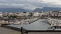 Port
Port Beach in the evening
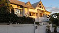 Hotel Villa Morgane
 Sunset


