Top Qs
Timeline
Chat
Perspective
List of state highways in Idaho
From Wikipedia, the free encyclopedia
Remove ads
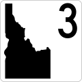
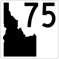
The Idaho Transportation Department (ITD) is responsible for the establishment and classification of a state highway network, including 5,000 miles (8,000 km) of roads that are classified as Interstate Highways, U.S. Highways, and state highways within the state of Idaho in the United States.[1] The current state highway marker consists of a white background, black numbering, and a solid black geographic outline of the state of Idaho.
Remove ads
History


During the 1920s, in lieu of numbering its highways, Idaho had a system of lettered Sampson Trails.[2] They were marked by businessman Charles B. Sampson of Boise at no expense to the state, using orange-colored shields.[3] By 1929, the trails system had included 6,500 miles (10,500 km) of marked highways that covered most of the state.[4] By the mid-1930s, the state had adopted a more standard system of numbered state highways.[5][6]
In 1978, the ITD began using brown state highway markers to denote scenic Idaho highways,[7] in addition to the main highway markers that featured a black background and white lettering and the name "IDAHO" in black lettering inside a white geographic outline of the state. The brown markers were discontinued around 2012, and in April 2020, ITD changed the coloring of the main state highway marker to its current color scheme, also adding a wide version of the marker for three-digit highways and removing the word "IDAHO" from all markers in the process.[8]
Remove ads
Sampson Trails
Summarize
Perspective

The following Sampson Trails were marked:[2]
- A, Boise to Wyoming via Twin Falls and Pocatello; became US-30 and US-30N
- B, Boise to Canada via Lewiston and Coeur d'Alene; became US-30, US-30N, US-95, and SH-1
- C, Pocatello to Montana via Idaho Falls; became US-91 and US-191
- D, Boise to New Meadows via Banks; became SH-15 (today's SH-55)
- E, not on the 1926 map
- F, Boise to Blackfoot via Stanley; became SH-21, SH-17, US-93 (today's SH-75), and SH-27
- G, Mountain Home to Picabo via Fairfield; became SH-22 (today's US-20)
- H, Bliss to Trude via Arco; became SH-24, SH-23, SH-22, SH-29, and an unnumbered road (today's US-20 and US-26)
- I, Pioneer to Idaho Falls; became an unnumbered road
- J, Nevada to Shoshone via Twin Falls; became US-93
- K, Utah to McCammon via Preston; became US-91
- L, not on the 1926 map
- M, Washington to Montana via Coeur d'Alene; became US-10
- N, Bonners Ferry to Montana;[citation needed] became US-2
- O, Oregon to Caldwell; became SH-49 and SH-18
- P, Utah to Downey; became SH-36
- Q, Declo to Fairfield; became SH-25 and SH-46
- R, not on the 1926 map
- S, Oregon to Nampa; became unnumbered road and SH-45
- T, Star to Grimes Pass; became SH-16, unnumbered road, and SH-17
- U, Utah to Montpelier; became SH-35
- V, Hailey to Stanley; became US-93 (today's SH-75)
- W, not on the 1926 map
- X, not on the 1926 map
- Y, Bonners Ferry to Canada; became US-95
Remove ads
State highways
Remove ads
See also
References
External links
Wikiwand - on
Seamless Wikipedia browsing. On steroids.
Remove ads


