Top Qs
Timeline
Chat
Perspective
Sorbas Basin
Geologic formation in Spain From Wikipedia, the free encyclopedia
Remove ads
The Sorbas Basin is a sedimentary basin around the town of Sorbas in Almeria Province in south-east Spain. It is believed to have been formed by extension, between two fault-bounded blocks which rotated anti-clockwise to take up the compression resulting from Europe's collision with Africa. The basin is filled with turbidites and evaporites of the Tortonian-Messinian ages of the Miocene Epoch.

It is a matter of some debate whether the basin dried out at the same time as the main Mediterranean basins.[1][2][3]
Remove ads
Basin fill
The basin is divided into the following members:
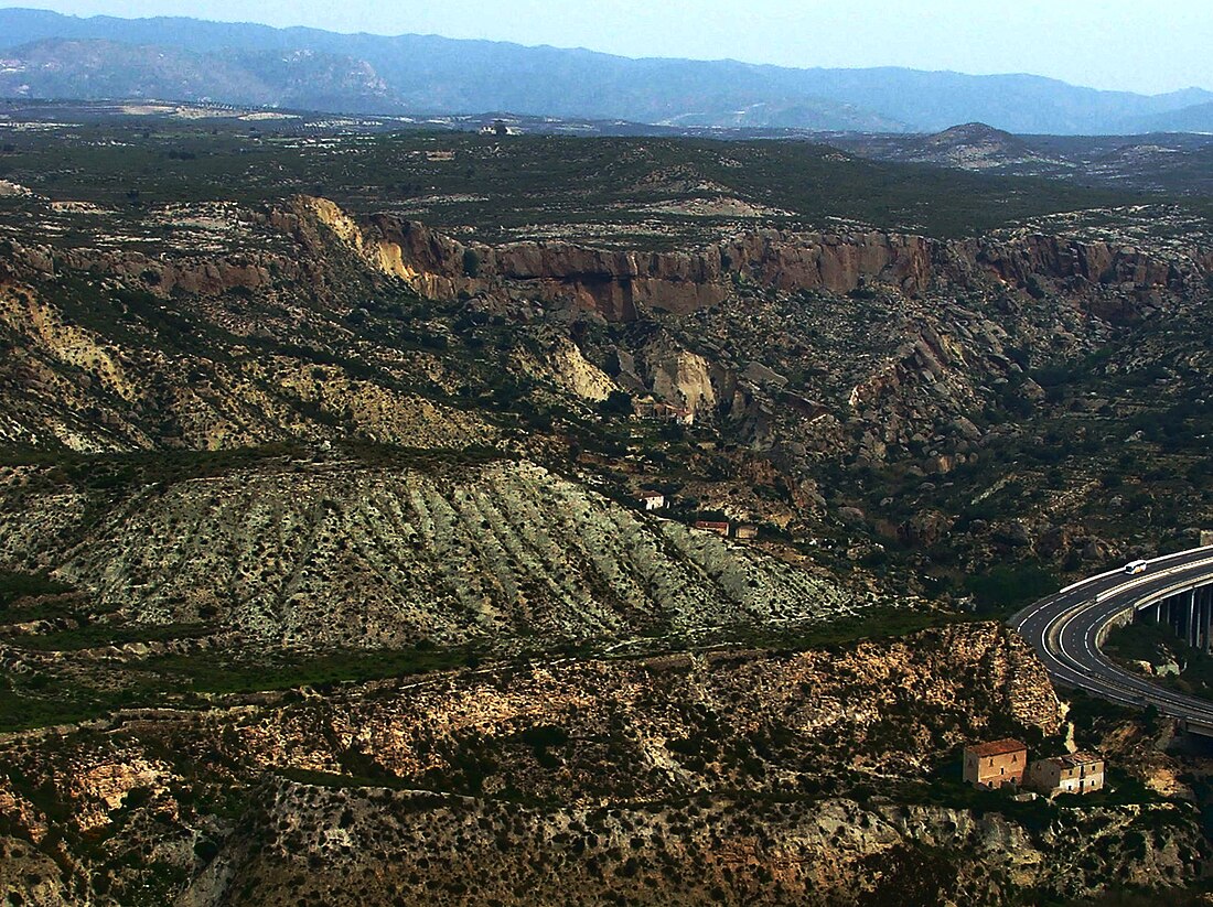
- At the bottom of the image, the house is constructed on the steep yellow cliffs of the resistant Azagador Member.
- The lower (whiter) and upper (yellower) Abad Marls, a Tortonian/Messinian series of turbidites featuring pronounced Milankovic (20,000 year precession) cyclicity, allowing chronostratigraphic dating; these fine muds are easily eroded.
- When the sea returned overdeepening the basin, salt water waterfalls eroded a 200 m depression patterned by 30 m deep gullies.[4]
- the Messinian Yesares Member, a gypsum evaporite, forms the steep bluffs at the top of the valley; there is some debate about how conformable its contact with the Abad marls is.
- Pliocene deposits, rest unconformably on the top.
- Complexity of drawdown and reflooding complicate correlation of the ‘Salinity Crisis' stratigraphy.
Remove ads
Basin significance

The basin was separated from the main Mediterranean basin during the Messinian salinity crisis; therefore the timing of the Yesares Member relative to the main basin evaporites is crucial to distinguish between models of how the Mediterranean dried out.
Remove ads
References
Wikiwand - on
Seamless Wikipedia browsing. On steroids.
Remove ads
