Top Qs
Timeline
Chat
Perspective
Kaiti, New Zealand
Suburb of Gisborne, New Zealand From Wikipedia, the free encyclopedia
Remove ads
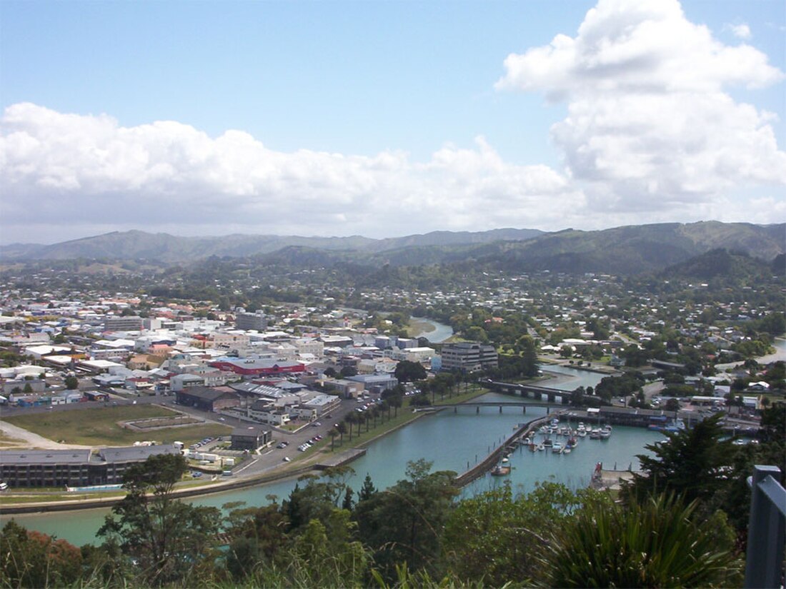
Kaiti (Māori: Kaitī) is a suburb of the New Zealand city of Gisborne. It is located immediately to the east of the city centre, on the opposing bank of the Waimata River.
Kaiti Hill or Titirangi overlooks Poverty Bay with Young Nick's Head (Te Kurī-a-Pāoa) across the Bay.[3] Titirangi also overlooks the city. The Turanganui River is below it and separates Kaiti from the Gisborne Central Business District.[4]
Kaiti Beach is one of New Zealand's most historic spots, being the landing site of the Horouta waka.[4] It brought ancestors of the tangata whenua to the region. In 1769, Captain James Cook, the first European to have set foot on New Zealand soil, also landed here. The location of this landing is protected as a national reserve.
The name kaiti comes from Māori words meaning "to eat the edible parts of cabbage trees (Cordyline australis)".
Remove ads
Demographics
Summarize
Perspective
Kaiti covers 6.20 km2 (2.39 sq mi)[1] and had an estimated population of 8,720 as of June 2024,[2] with a population density of 1,406 people per km2.
Kaiti had a population of 8,217 in the 2023 New Zealand census, an increase of 411 people (5.3%) since the 2018 census, and an increase of 1,323 people (19.2%) since the 2013 census. There were 3,984 males, 4,203 females, and 30 people of other genders in 2,442 dwellings.[7] 2.8% of people identified as LGBTIQ+. The median age was 32.8 years (compared with 38.1 years nationally). There were 2,016 people (24.5%) aged under 15 years, 1,740 (21.2%) aged 15 to 29, 3,333 (40.6%) aged 30 to 64, and 1,125 (13.7%) aged 65 or older.[5]
People could identify as more than one ethnicity. The results were 44.0% European (Pākehā); 68.3% Māori; 8.7% Pasifika; 3.1% Asian; 0.5% Middle Eastern, Latin American and African New Zealanders (MELAA); and 1.1% other, which includes people giving their ethnicity as "New Zealander". English was spoken by 95.1%, Māori by 20.6%, Samoan by 0.5%, and other languages by 5.5%. No language could be spoken by 2.4% (e.g. too young to talk). New Zealand Sign Language was known by 0.5%. The percentage of people born overseas was 9.6, compared with 28.8% nationally.[5]
Religious affiliations were 29.3% Christian, 0.2% Hindu, 0.4% Islam, 7.3% Māori religious beliefs, 0.4% Buddhist, 0.5% New Age, and 1.4% other religions. People who answered that they had no religion were 52.6%, and 8.7% of people did not answer the census question.[5]
Of those at least 15 years old, 930 (15.0%) people had a bachelor's or higher degree, 3,348 (54.0%) had a post-high school certificate or diploma, and 1,923 (31.0%) people exclusively held high school qualifications. The median income was $32,400, compared with $41,500 nationally. 288 people (4.6%) earned over $100,000 compared to 12.1% nationally. The employment status of those at least 15 was 2,733 (44.1%) full-time, 834 (13.4%) part-time, and 357 (5.8%) unemployed.[5]
Remove ads
Geography
Titirangi Hill
Titirangi Hill is a reserve with a dog walking area, fitness trail, picnic area, playground and lookout spot.[11]
The Kaiti Beach reserve, at the south-west base of the hill, is a beach, local park and dog walking area.[11]
Other parks
Anzac Park includes a barbecue area, boat ramp, football fields, picnic area and playground.[11]
Waikirikiri Reserve is a sports ground, dog walking area and picnic area.[11]
London Street Reserve is a local park and dog walking area.[11]
Remove ads
Marae
Te Poho-o-Rawiri Marae is located in Kaiti. It is a tribal meeting ground of the Ngāti Porou hapū of Ngāti Konohi and Ngāti Oneone,[12] and includes Te Poho o Rawiri meeting house.[13]
In October 2020, the Government committed $1,686,254 from the Provincial Growth Fund to upgrade Te Poho-o-Rawiri Marae and 5 other Rongowhakaata marae, creating an estimated 41 jobs.[14]
Education
Kaiti School is a Year 1–6 state primary school[15] with a roll of 412.[16][17] It opened in 1906.[18]
Te Wharau School is a Year 1–6 primary school[19] with a roll of 322.[20][21] It opened in 1954.[22]
Ilminster Intermediate is a Year 7–8 state intermediate school[23] with a roll of 302.[24] It opened in 1960.[25]
Waikirikiri School is a Year 1–8 state primary school[26] with a roll of 208.[27] It opened in 1967.[28]
All these schools are co-educational. Rolls are as of July 2025.[29]
Remove ads
References
Wikiwand - on
Seamless Wikipedia browsing. On steroids.
Remove ads


