Top Qs
Timeline
Chat
Perspective
Werra
River in central Germany From Wikipedia, the free encyclopedia
Remove ads
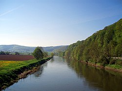
The Werra (German pronunciation: [ˈvɛʁa] ⓘ), a river in central Germany, is the right-bank headwater of the Weser. "Weser" is a synonym in an old dialect of German. The Werra has its source near Eisfeld in southern Thuringia. After 293 kilometres (182 mi) the Werra joins the river Fulda in the town of Hann. Münden, forming the Weser. If the Werra is included as part of the Weser, the Weser is the longest river entirely within German territory at 744 kilometres (462 mi).
Its valley, the Werratal, has many tributaries and is a relative lull between the Rhön Mountains and the Thuringian Forest.
Its attractions include Eiben Forest near Dermbach, an unusual sandstone cave at Walldorf, the deepest lake in Germany formed by subsidence (near Bernshausen), and Krayenburg, the ruins of a castle.
The towns and main settlements along the Werra are Hildburghausen, Meiningen, Bad Salzungen, Tiefenort, Merkers-Kieselbach, Vacha, Heringen, Philippsthal, Gerstungen, Wanfried, Eschwege, Bad Sooden-Allendorf, Witzenhausen and Hannoversch Münden.
Remove ads
Gallery
See also
References
External links
Wikiwand - on
Seamless Wikipedia browsing. On steroids.
Remove ads


