Top Qs
Timeline
Chat
Perspective
Xinye County
County in Henan, People's Republic of China From Wikipedia, the free encyclopedia
Remove ads
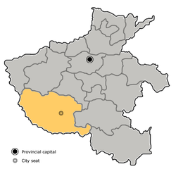
Xinye (Chinese: 新野; pinyin: Xīnyě; Wade–Giles: Hsin-yeh) is one of the counties of Nanyang[3] that lies in the southwest of Henan province, China. To the south lies the prefecture-level city of Xiangyang in Hubei province, to the east is Tanghe County and to the west is the county-level city of Dengzhou. According to the 2020 Chinese Census, the population of Xinye county is 602,827.[2] Its total area is 1,062 km2 (410 sq mi).
This article needs additional citations for verification. (November 2006) |
The G55 Erenhot–Guangzhou Expressway runs through Waizi town, which is the northmost town of Xinye. Both Nanyang Jiangying Airport and Xiangyang Liuji Airport are about 60 km (37 mi) away from Xinye.

Remove ads
History
This section needs expansion. You can help by adding to it. (August 2012) |
Near the end of the Han Dynasty, the warlord Liu Bei used Xinye as a base, as a vassal under Liu Biao. Liu Biao himself had been residing in Xiangyang. Liu Bei lost Xinye to Cao Cao in 208 and retreated to the southeast in prelude to the battle of the Red Cliffs.[4]
Administrative divisions
As of 2012, this county is divided to 2 subdistricts, 8 towns and 5 townships.[5]
- Subdistricts
- Hanhua Subdistrict (汉华街道)
- Hancheng Subdistrict (汉城街道)
- Towns
|
|
- Townships
|
|
Remove ads
Climate
References
Wikiwand - on
Seamless Wikipedia browsing. On steroids.
Remove ads


