Map Graph

Geography of Australia

The geography of Australia describes the systematic study of Australian sovereign territory, which, in a geographical sense, refers to the mainland Australia, the insular state of Tasmania and thousands of minor islands spread over the Pacific, Indian and Southern oceans and surrounding the mainland landmass which, together, comprise a territorial area of 7,688,287 km2 (2,968,464 sq mi). Given its vast size, Australia's geography is extremely diverse, ranging from the snow-capped mountains of the Australian Alps and Tasmania to large deserts, tropical and temperate forests, grasslands, heathlands and woodlands.

Read article
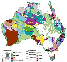
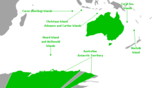
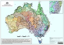
File:Australia_satellite_plane.jpgFile:Reliefmap_of_Australia.pngFile:Topography_of_Tasmania.jpgFile:Ausgeolbasic.jpgFile:Drainage_Divisions_of_Australia.svgFile:Australian_ocean_currents.pngFile:Australia_Exclusive_Economic_Zones.pngFile:Australian_external_territories.pngFile:Australia_Population_Density,_2000_(6171903217)_(cropped).jpgFile:Australia_map_of_Köppen_climate_classification.svgFile:Time_in_Australia.svgFile:Interim_Biogeographic_Regionalisation_for_Australia,_version_7.pdfFile:Queensland_Panorama.jpgFile:Kosciuszko_Dawn.jpgFile:Blue_Mountians_180_Panorama_(Megalong_Valley).jpgFile:Outback_view_from_Chambers_Pillar.jpg
Top Questions
AI generated

List the top facts about Geography of Australia

Summarize this article

What is the single most intriguing fact about Geography of Australia?

Are there any controversies surrounding Geography of Australia?

More questions