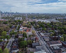
Bathurst Street (Toronto)
Street in Toronto and York Region in Ontario, CanadaBathurst Street is a main north–south arterial road in Toronto, Ontario, Canada. It begins at an intersection of the Queens Quay roadway, just north of the Lake Ontario shoreline. It continues north through Toronto to the Toronto boundary at Steeles Avenue. It is a four-lane thoroughfare throughout Toronto. The street continues north into York Region where it is designated York Regional Road 38, and ends in the Holland Marsh.
Read article
Top Questions
AI generatedMore questions
Nearby Places

Tarragon Theatre
Theatre in Toronto, Canada

Dupont station
Toronto subway station

Baldwin Steps
Staircase in Toronto

Casa Loma (neighbourhood)
Neighbourhood in Toronto, Ontario, Canada

Wychwood Park
Neighbourhood in Toronto, Ontario, Canada

Casa Loma
Mansion in Toronto, Canada
Oliphant's Gym

Hillcrest Complex
Maintenance facility of the Toronto Transit Commission


