Bougainville Island
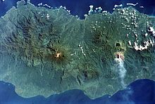
Island in Papua New GuineaBougainville Island is the main island of the Autonomous Region of Bougainville, which is part of Papua New Guinea. Its land area is 9,300 km2 (3,600 sq mi). The highest point is Mount Balbi, on the main island, at 2,715 m (8,907 ft).
Read article
Top Questions
AI generatedMore questions
Nearby Places

North Solomon Islands
Island group in Western Pacific


