Briar Hill (Michigan)
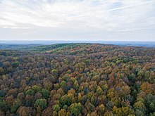
Highest point in the lower peninsula of MichiganBriar Hill, at 1,706 ft, is the second-highest point in the Lower Peninsula of Michigan, behind nearby Grove Hill at 1,709 feet. It is entirely within the Manistee National Forest. The area was carved out during the last ice age, and retreating glaciers left large deposits of sand, which created Briar Hill and the nearby Caberfae Hills.
Read article
Top Questions
AI generatedMore questions
Nearby Places

Wexford County, Michigan
County in Michigan, United States

Antioch Township, Michigan
Civil township in Michigan, United States

Boon Township, Michigan
Civil township in Michigan, United States

Harrietta, Michigan
Village in Michigan, United States

Mesick, Michigan
Village in Michigan, United States

Springville Township, Michigan
Civil township in Michigan, United States

Sherman, Michigan
Unincorporated community in Michigan, United States
WLXV
Radio station in Cadillac, Michigan


