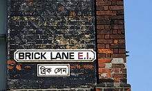
Brick Lane
Street in East London, EnglandBrick Lane is a street in the East End of London, in the borough of Tower Hamlets. It runs from Swanfield Street in Bethnal Green in the north, crosses the Bethnal Green Road before reaching the busiest, most commercially active part which runs through Spitalfields, or along its eastern edge. Brick Lane's southern end is connected to Whitechapel High Street by a short extension called Osborn Street.
Read article
Top Questions
AI generatedMore questions
Nearby Places

Shoreditch tube station
Former London Underground station

Black Eagle Brewery
Brewery building in London Borough of Tower Hamlets, England

Bishopsgate (Low Level) railway station
Disused railway station in London, England

Boishakhi Mela
Bengali celebration
Wlodawa Synagogue (London)
Former Orthodox synagogue in London, England, 1901–1987

Brick Lane Market
Markets in London centered on Brick Lane

Cereal Killer Cafe
Chain of cafés serving branded breakfast cereals
Freedom for Humanity
Temporary mural in London, England


