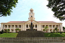
Bukit Timah
Area in Central Region, SingaporeBukit Timah, often abbreviated as Bt Timah, is a planning area and residential estate located in the westernmost part of the Central Region of Singapore. Bukit Timah lies roughly 10 kilometres (6.2 mi) from the Central Business District, bordering the Central Water Catchment to the north, Bukit Panjang to the northwest, Queenstown to the south, Tanglin to the southeast, Clementi to the southwest, Novena to the east and Bukit Batok to the west. It is further split into eight subzones, namely Anak Bukit, Coronation Road, Farrer Court, Hillcrest, Holland Road, Leedon Park, Swiss Club and Ulu Pandan.
Read article
Top Questions
AI generatedMore questions
Nearby Places

The Chinese High School (Singapore)
Independent, boys-only school in Singapore
Hwa Chong Junior College
Independent school in Bukit Timah, Singapore

Hwa Chong Institution
Independent School in Central Region, Singapore

National Junior College
Junior college in Singapore founded 1969

Nanyang Girls' High School
Independent school in Bukit Timah

Hwa Chong International School
International school in Singapore
Singapore Institute of Management
Private university in Singapore

The Chinese High School Clock Tower Building
Historic site in Bukit Timah Road Singapore


