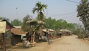
Chitwan District
District in Bagmatti Pradesh, NepalChitwan District is one of seventy-seven districts of Nepal, and takes up the southwestern corner of Bagmati Province. Bharatpur, largest city of Nepal after Kathmandu, is its administrative centre. It covers 2,238.39 km2 (864.25 sq mi), and in 2011 had a population of 579,984 people. Bharatpur is the commercial and service centre of South Central Nepal and a major destination for higher education, health care and transportation in the region. Chitwan lies in the Terai region of Nepal. It is in the drainage basin of the Gandaki River and is roughly triangular, taking that river as its meandering northwestern border, and a modest watershed border, with India, as the basis of its southern limit. Local government: Bharatpur Metropolitan, Rapti Municipality, Ratnanagar Municipality, Kalika Municipality, Khairahani Municipality, Madi Municipality, Ikshyakamana Gaupalika
Read article


_2.jpg)


Top Questions
AI generatedMore questions
Nearby Places
Bairiya
Village in Chitwan
Bachhayauli
Village development committee in Bagmati Province, Nepal

Kumroj
Place in Narayani Zone, Nepal
Sauraha
Village in Ratnanagar Municipality in Bagmati Province, Nepal

Bishazari Tal
Oxbow lake in Chitwan, Nepal
Jamunapur
Khairahani
Municipality in Bagmati Province, Nepal

Secondary School Gawai
Public school in Chitwan