Cranham
A residential area of East London, EnglandCranham is a residential area of the London Borough of Havering. It is located 17.5 miles (28 km) east-northeast of Charing Cross and comprises an extensive built-up area to the north and a low density conservation area to the south surrounded by open land. It was historically a rural village in the county of Essex and formed an ancient parish. It is peripheral to Upminster, forming the eastern edge of the urban sprawl of Havering. The economic history of Cranham is characterised by a shift from agriculture to housing development. As part of the suburban growth of London in the 20th century, Cranham significantly increased in population, becoming part of Hornchurch Urban District in 1934 and has formed part of Greater London since 1965. The 2011 Census population of Cranham was included in Upminster.
Read article


Top Questions
AI generatedMore questions
Nearby Places

Coopers' Company and Coborn School
Academy in Upminster, Greater London, England

Upminster Tithe Barn
Historic building in Upminster, London
Eastbrook School
Community school in London, England
Upminster Hall
Building in Upminster, London, England
Hall Mead School
Academy in Upminster, Greater London, England
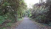
Cranham Brickfields
Nature reserve in Greater London, England

Upminster Depot
Railway depot in Cranham, London
Cranham (ward)