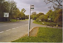
Cranleigh
Village and parish in Surrey, EnglandCranleigh is a village and civil parish in the Borough of Waverley, Surrey, England. It lies 8 miles (13 km) southeast of Guildford on a minor road east of the A281, which links Guildford with Horsham. It is in the north-west corner of the Weald, a large remnant forest, the main local remnant being Winterfold Forest directly north-west on the northern Greensand Ridge. In 2011 it had a population of just over 11,000.
Read article
Top Questions
AI generatedMore questions
Nearby Places
Cranleigh School
Boarding school in Cranleigh near Guildford, Surrey, England

Ewhurst, Surrey
Village and parish in Surrey, England

Cranleigh railway station
Former railway station in England
Glebelands School
Community school in Cranleigh, Surrey, England
Sayers Croft

Baynards Park
Privately owned park in Surrey, England

Sayer's Croft LNR

Longhurst Lodge
Historic house in Surrey, England


