Derry
City in Northern IrelandDerry, officially Londonderry, is the second-largest city in Northern Ireland, and the fifth-largest on the island of Ireland. Located in County Londonderry, the city now covers both banks of the River Foyle. Cityside and the old walled city being on the west bank and Waterside on the east, with two road bridges and one footbridge crossing the river in-between.
Read article


Top Questions
AI generatedMore questions
Nearby Places
Bloody Sunday (1972)
Mass shooting in Derry, Northern Ireland

Millennium Forum
Theatre and conference centre in Derry, Northern Ireland
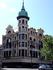
Austins (department store)
Former department store in Derry
Richmond Centre (Derry)
Shopping mall in Derry, Northern Ireland

Guildhall, Derry
Municipal Building in Derry, Northern Ireland

Peace Bridge (Foyle)
Bridge in Derry, Northern Ireland

Diamond War Memorial
Void Gallery
Contemporary art gallery in Northern Ireland