Division of Melbourne Ports
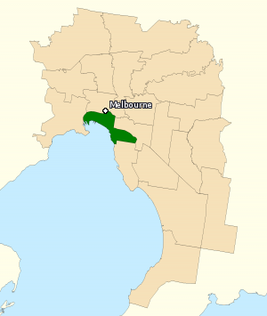
Former Australian federal electoral divisionThe Division of Melbourne Ports was an Australian federal electoral division in the inner south-eastern suburbs of Melbourne, Victoria, Australia. It was located to the south of Melbourne's central business district and covered an area of approximately 40 km2 around the north and north-eastern shores of Port Phillip Bay.
Read article
Top Questions
AI generatedMore questions
Nearby Places

St Kilda West
Suburb of Melbourne, Victoria, Australia

St Kilda light rail station
Tram stop in Victoria, Australia

St Kilda Junction
Road intersection in St Kilda, Australia

Junction Oval
Australian sports ground
Middle Park Stadium
Soccer venue in Middle Park, Victoria
Mansion nightclub
Historic building in Melbourne, Australia

Crystal Ballroom (Melbourne)
Music venue in Melbourne, Victoria, Australia
Division of Macnamara
Australian federal electoral division


