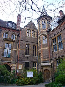
Downing Street, Cambridge
Street in Cambridge, EnglandDowning Street is a street in central Cambridge, England. It runs between Pembroke Street and Tennis Court Road at the western end and a T-junction with St Andrew's Street at the eastern end. Corn Exchange Street and St Tibbs Row lead off to the north. Downing Place leads off to the south.
Read article
Top Questions
AI generatedMore questions
Nearby Places

Department of Plant Sciences, University of Cambridge
Academic department of the University of Cambridge

Department of Earth Sciences, University of Cambridge
UK academic institution

Downing Site
Site of the University of Cambridge

Cambridge Medical School building

Downing Place United Reformed Church, Cambridge
Church building in Cambridge, England

Museum of Archaeology and Anthropology, University of Cambridge
University Museum in Cambridge

Sedgwick Museum of Earth Sciences
Science museum in England
Godwin Laboratory, University of Cambridge
Research facility at the University of Cambridge


