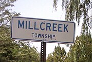
Erie Triangle
Tract of land in northwestern PennsylvaniaThe Erie Triangle is a roughly 300-square-mile (780-square-kilometre) tract of land that was the subject of several competing colonial-era claims. It was eventually acquired by the U.S. federal government and sold to Pennsylvania so that the state would have access to a freshwater port on Lake Erie. The Erie Triangle land makes up a large portion of present-day Erie County, Pennsylvania.
Read article
Top Questions
AI generatedMore questions
Nearby Places

Erie County, Pennsylvania
County in Pennsylvania, United States

Millcreek Mall
Shopping mall in Erie, Pennsylvania

Splash Lagoon
Polynesian-themed indoor waterpark

Erie Zoo
Zoo in Pennsylvania, U.S.
Pennsylvania House of Representatives, District 3
American legislative district
Bethel Christian School (Pennsylvania)
School in Pennsylvania, United States

Our Lady of Peace Church (Erie, Pennsylvania)
Erie First Assembly of God
Church in Pennsylvania, United States

