Map Graph

German East Africa

1885–1918 German colony including modern Tanzania, Burundi and Rwanda

German East Africa was a German colony in the African Great Lakes region, which included present-day Burundi, Rwanda, the Tanzania mainland, and the Kionga Triangle, a small region later incorporated into Mozambique. GEA's area was 994,996 km2 (384,170 sq mi), which was nearly three times the area of present-day Germany and almost double the area of metropolitan Germany at the time.

Read article
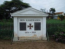
File:Reichskolonialflagge.svgFile:Wappen_Deutsches_Reich_-_Reichsadler_1889.svgFile:German_East_Africa_1914.svgFile:Eckenbrecher_Tropische_Landschaft_in_Deutsch-Ostafrika.jpgFile:Bundesarchiv_Bild_105-DOA0162,_Deutsch-Ostafrika,_Daressalam,_Strassenbild.jpgFile:Fort_von_Bagamono.jpgFile:German_East_Africa,_1_rupee,_1902.jpgFile:German_WW1_Memorial_in_Iringa.jpgFile:GEA-49-Deutsch_Ostafrikanische_Bank-200_Rupien_(1915).jpgFile:Der_Durchbruch_der_Schutztruppe_Deutsch-Ostafrika_über_den_Rowuma_MItte_November_1917._Darstellung_von_Carl_Arriens.jpgFile:German_East_Africa_MKL_Bd._14_1890_(128624470).jpgFile:Deutsch_Ost-Afrika,1892.jpgFile:1911GermanEastAfrica.pngFile:World_War_I_in_East_Africa.jpgFile:Bundesarchiv_Bild_105-DOA0876,_Deutsch-Ostafrika,_Sisalfabrik.jpgFile:Bundesarchiv_Bild_105-DOA3056,_Deutsch-Ostafrika,_Askarikompanie.jpgFile:Bundesarchiv_Bild_105-DOA0184,_Deutsch-Ostafrika,_Wuga,_Schule.jpgFile:Bundesarchiv_Bild_105-DOA3114,_Deutsch-Ostafrika,_Reiter_zu_Pferd.jpgFile:Proposed_Flag_of_German_East_Africa.svgFile:Proposed_Coat_of_Arms_East_Africa_1914.svg
Top Questions
AI generated

List the top facts about German East Africa

Summarize this article

What is the single most intriguing fact about German East Africa?

Are there any controversies surrounding German East Africa?

More questions