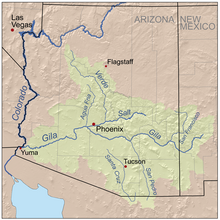
Gila River
River in New Mexico and Arizona, United StatesThe Gila River is a 649-mile-long (1,044 km) tributary of the Colorado River flowing through New Mexico and Arizona in the United States. The river drains an arid watershed of nearly 60,000 square miles (160,000 km2) that lies mostly within the U.S., but also extends into northern Sonora, Mexico.
Read article
Top Questions
AI generatedMore questions
Nearby Places

Yuma Territorial Prison
19th-century prison in Arizona, US

Yuma station
Rail station in Arizona
Gila Ridge High School
Public high school in Yuma, Arizona, United States
Yuma station (Southern Pacific Railroad)
United States historic place

Paradise Casino
Casino in Yuma, Arizona
San Pasqual Valley High School
Public high school in Winterhaven, California, United States
El Prado Estates, Arizona
CDP in Yuma County, Arizona

Hotel del Ming
Historic hospital in arizona


