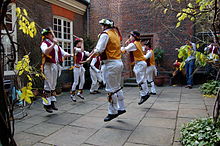
Hackney, London
District in East London, EnglandHackney is a district in East London, England, forming around two-thirds of the area of the modern London Borough of Hackney, to which it gives its name. It is 4 miles (6.4 km) northeast of Charing Cross and includes part of the Queen Elizabeth Olympic Park. Historically it was within the county of Middlesex.
Read article
Top Questions
AI generatedMore questions
Nearby Places

Metropolitan Borough of Hackney
Borough of the County of London from 1900 to 1965

London Fields
Human settlement in England

London Fields railway station
London Overground station

Miniscule of Sound

Hackney South and Shoreditch (UK Parliament constituency)
Parliamentary constituency in the United Kingdom, 1974 onwards

Hackney Central
Human settlement in England

Hackney Museum
Local museum in London, England

Hackney Town Hall
Municipal building in London, England


