Hellidon
Village in Northamptonshire, EnglandHellidon is a village and civil parish about 5 miles (8 km) south-west of Daventry in Northamptonshire, England. The parish area is about 1,600 acres (650 ha). It lies 520 feet (160 m) – 590 feet (180 m) above sea level on the north face of an ironstone ridge, its highest point, 670 feet (200 m) at Windmill Hill, being 0.5 miles (800 m) south-east of the village. The Leam and tributaries rise in the parish. The 2011 Census gave a population of 256, estimated at 286 in 2019. The long-distance Jurassic Way footpath linking Banbury, Oxfordshire, and Stamford, Lincolnshire, passes through. The origin of the name is unclear. "Holy Valley", "Haegla's Valley" and "Unstable valley" have been suggested, with the Old English "dun", meaning hill.
Read article

.svg)


Top Questions
AI generatedMore questions
Nearby Places

Upper Catesby
Hamlet in Northamptonshire, England

Lower Catesby
Hamlet in Northamptonshire, England
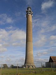
Charwelton BT Tower
Telecommunication tower in England

Arbury Hill

Charwelton railway station
Former railway station in Northamptonshire, England

Catesby, Northamptonshire
Civil parish in West Northamptonshire, England
Catesby Priory
Priory of Cistercian nuns in England

Catesby Tunnel
Former railway tunnel in England