Hinterstoder
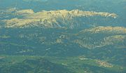
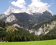
Municipality in Upper Austria, AustriaHinterstoder is a municipality in the district of Kirchdorf an der Krems, in the Austrian state of Upper Austria. The village lies on the southern edge of the district near the border with Styria, at an altitude of around 600 m. Surrounded by the limestone peaks of the Totes Gebirge range, including the Großer Priel (2,514 m) and the Spitzmauer (2,446 m), Hinterstoder has developed from a small alpine settlement into an internationally recognized ski resort.
Read article


Top Questions
AI generatedMore questions