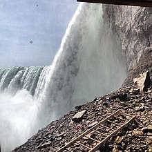
Horseshoe Falls
Largest portion of Niagara Falls on the United States–Canada borderHorseshoe Falls is the largest of the three waterfalls that collectively form Niagara Falls on the Niagara River along the Canada–United States border. Approximately 90% of the Niagara River, after diversions for hydropower generation, flows over Horseshoe Falls. The remaining 10% flows over American Falls and Bridal Veil Falls. It is located between Terrapin Point on Goat Island in the US state of New York, and Table Rock in the Canadian province of Ontario. These falls are also referred to as the Canadian Falls.
Read article
Top Questions
AI generatedMore questions
Nearby Places

Niagara River
River in New York, United States and Ontario, Canada

Niagara Falls
Waterfalls between United States and Canada

Journey Behind the Falls
Attraction in Niagara Falls, Ontario, Canada

Table Rock, Niagara Falls
Former rock formation

Cedar Island (Niagara River)

Terrapin Point
Observation area in Niagara Falls, New York

Table Rock Welcome Centre
Building in Niagara Falls, Ontario, Canada

Queen Victoria Park
Parkland in Niagara Falls, Ontario


