Knighton, Powys
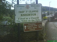
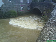
Town on the Wales-England borderKnighton is a market town and community on the River Teme, straddling the border between Powys, Wales and Shropshire, England. It lies in the traditional county of Radnorshire. Originally an Anglo-Saxon settlement, Knighton is located on Offa's Dyke, the ancient earthwork that divided the two countries. It later became a Norman defensive border town.
Read article
Top Questions
AI generatedMore questions
Nearby Places

Offa's Dyke
Ancient earthwork in the United Kingdom
Glyndŵr's Way
Long-distance footpath in Wales

Knighton railway station
Railway station in Shropshire, England
Milebrook
Hamlet in Powys, Wales

Nether Skyborry
Human settlement in England

Knighton Rural District
Rural district in the administrative county of Radnorshire, Wales (1894–1974)

Knighton Community Centre

Knighton Hospital
Hospital in Powys, Wales


