Lake Poopó
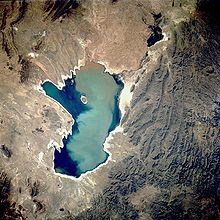
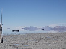
Saline lake in BoliviaLake Poopó was a large saline lake in a shallow depression in the Altiplano in Oruro Department, Bolivia, at an altitude of approximately 3,700 m (12,100 ft). Due to the lake's length and width, it made up the eastern half of Oruro, known as a mining region in southwest Bolivia. The permanent part of the lake body covered approximately 1,000 square kilometres (390 sq mi) and it was the second-largest lake in the country. The lake received most of its water from the Desaguadero River, which flows from Lake Titicaca at the north end of the Altiplano. Since the lake lacked any major outlet and had a mean depth of less than 3 m (10 ft), the surface area differed greatly seasonally.
Read article
Top Questions
AI generatedMore questions


