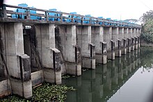
Lakshmipur District
District of Bangladesh in Chattogram DivisionLakshmipur District is a district in Bangladesh with an area of 1,440 km2. It is bordered by Chandpur to the north, Bhola and Noakhali districts to the south, Noakhali to the east, and Barisal and Bhola districts to the west. Lakshmipur was part of Noakhali until 15 February 1984, when the western part of Noakhali was reorganised from Lakshmipur subdivision into Lakshmipur district to improve administrative efficiency.
Read article
Top Questions
AI generatedMore questions
Nearby Places

Lakshmipur Sadar Upazila
Upazila in Chittagong, Bangladesh

Lakshmipur
City in Lakshmipur District, Chittagong Division
Lakshmipur Stadium
Cricket stadium in Bangladesh

Moju Chowdhury Hat
Town in Chittagong, Bangladesh

Lakshmipur Adarsha Samad Government High School
Government school in Chittagong, Bangladesh

Lakshmipur Government College


