Lewis-Clark Valley AVA
Lewis-Clark Valley is Idaho's third American Viticultural Areas (AVA) officially established by the Alcohol and Tobacco Tax and Trade Bureau (TTB), Treasury on May 20, 2016. It borders the northern part of the established Columbia Valley AVA. The region encompasses 479 square miles with nearly 100 acres (40 ha) under vine throughout the Lewis-Clark Valley between the Clearwater and mid-Snake Rivers and their tributaries. About 72%, 219,838 acres (343.497 sq mi), is located in Idaho with the rest in Washington. The topography consists primarily of deep, V-notched canyons, low plateaus, and bench lands formed by the two rivers. There were 3 wineries within the appellation, as well as 16 commercially-producing vineyards with elevations approximately below 2,000 feet (610 m). Lewis-Clark Valley boundaries forced the realignment of the existing Columbia Valley viticultural area by expanding into its area based on topography, climate and soil conditions. The realignment more accurately separated the terroir differences between the two appellations. Roughly about 72% of Lewis-Clark Valley is located in Idaho and the rest in Washington.
Read article
Top Questions
AI generatedMore questions
Nearby Places
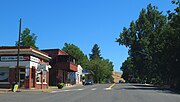
Juliaetta, Idaho
City in Idaho, United States

Spalding, Idaho
Unincorporated community in northern Nez Perce County, Idaho

Nez Perce National Historical Park
Series of federally protected historic sites in the northwestern United States
Camp Lapwai
US army encampment

Fort Lapwai
Historic fortification of the American Civil War in Idaho

Potlatch River
River in Idaho