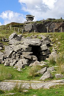
Linkinhorne
Civil parish and village in south-east Cornwall, EnglandLinkinhorne is a civil parish and village in southeast Cornwall, England, United Kingdom. The village itself is situated at grid reference SX 320 736 and is approximately four miles (6.4 km) northwest of Callington and seven miles (11 km) south of Launceston. The parish population at the 2011 census including Downgate was 1,541
Read article
Top Questions
AI generatedMore questions
Nearby Places
Bray Shop
Human settlement in England

South Hill, Cornwall
Human settlement in England

Golberdon
Human settlement in England

Kersbrook Cross
Human settlement in England

Mornick
Hamlet in Cornwall, England

Plushabridge
Human settlement in England

Rilla Mill
Village in Cornwall, England

Rillaton
Hamlet in Cornwall, England


