No coordinates found
Low-water crossing
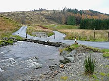
Roadway usable only at low water levelsA low-water crossing is a low-elevation roadway traversing over a waterbody that stays dry above the water when the flow is low, but is designed to get submerged under high-flow conditions such as floods. This type of crossing is much cheaper to build than a high bridge that keeps the road surface consistently above the highest water level, and is usually deployed in semi-arid areas where high-volume rainfall is rare and the existing channel is shallow, particularly in developing countries.
Read article
Top Questions
AI generatedMore questions


