Manamadurai
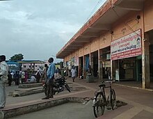
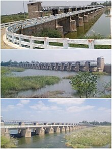
A First Grade Municipality in Sivagangai DistrictManamadurai is a Municipality Town in Sivaganga district in the Indian state of Tamil Nadu, Situated 58 kilometres away from the heart of Madurai on the Cochin - Dhanushkodi National Highway. It is the 4th Largest Town in the Sivaganga district followed by Karaikudi, Sivaganga and Devakottai. Manamadurai represents its seat in Manamadurai Legislative assembly constituency. It is a river-based settlement town developed on banks of river Vaigai around 2 BCE. The River flows through the core of town dividing the town into Upper Western banks and lower eastern banks.
Read article
Top Questions
AI generatedMore questions
Nearby Places
Pudukulam
Village in Tamil Nadu, India
Idaikattur
Village in Tamil Nadu, India

Manamadurai Assembly constituency
One of the 234 State Legislative Assembly Constituencies in Tamil Nadu, in India
Manamadurai taluk
Taluk of Tamil Nadu, India
Parthibanur
Town in Tamil Nadu, India

Thirumeninathar temple
Hindu temple in Tamil Nadu, India


