Manipur
State in northeastern IndiaManipur is a state in northeastern India with Imphal as its capital. It borders the Indian states of Assam to the west, Mizoram to the south, and Nagaland to the north and shares the international border with Myanmar, specifically the Sagaing Region to the east and Chin State to the southeast. Covering an area of 22,330 square kilometers (8,621 mi²), the state consists mostly of hilly terrain with the 1813-square-kilometre (700 mi²) Imphal Valley inhabited by the Meitei (Manipuri) community, historically a kingdom. Surrounding hills are home to Naga and Kuki-Zo communities, who speak Tibeto-Burman languages. The official language and lingua franca, Meitei (Manipuri), also belongs to the Tibeto-Burman family.
Read article
Top Questions
AI generatedMore questions
Nearby Places

Imphal
Capital city of the Indian state Manipur

Kangla fort
Fortified Palace in Manipur, India
Johnstone Higher Secondary School, Imphal
Government school in Imphal, Manipur, India

Ima Market
Place in Manipur, India

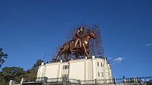
Statue of Meidingu Nara Singh
Monument in Imphal, India

Kangla Sanathong
Western entrance gate to the Kangla Fort

Pakhangba Temple, Kangla
Meitei temple inside the Kangla Fort

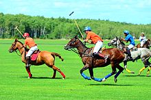
Manung Kangjeibung
Polo Ground located inside the Kangla fort in Imphal


