Map Graph
No coordinates found

Velarde map

Map of the early colonial Philippines, noted for its comprehensiveness

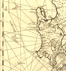
Carta Hydrographica y Chorographica de las Islas Filipinas, more commonly known as the Velarde map, is a map of the Philippines made and first published in Manila in 1734 by the Jesuit cartographer Pedro Murillo Velarde, the engraver Nicolás de la Cruz Bagay, and the artist Francisco Suárez. The World Digital Library describes it as the "first and most important scientific map of the Philippines". It is frequently referred to as the "Mother of all Philippine Maps".

Read article
File:Carta_Hydrographica_y_Chorographica_de_las_Yslas_Filipinas_Dedicada_al_Rey_Nuestro_Señor_por_el_Mariscal_d._Campo_D._Fernando_Valdes_Tamon_Cavallº_del_Orden_de_Santiago_de_Govor._Y_Capn.jpgFile:Carta_hydrographica_y_chorographica_de_las_Yslas_Filipinas_-_Biblioteca_Nacional_de_España.jpgFile:Mapa_de_las_yslas_Philipinas_(2675427656).jpgFile:Carta_Hydrographica_y_Chorographica_de_las_Yslas_Filipinas.jpgFile:1774_map_of_the_Philippine_Islands.jpgFile:Galit_panacot_lumbay.pngFile:Scarboro_from_Mannevillette.png
Top Questions
AI generated

List the top facts about Velarde map

Summarize this article

What is the single most intriguing fact about Velarde map?

Are there any controversies surrounding Velarde map?

More questions