Naguabo, Puerto Rico
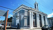
Town and municipality in Puerto RicoNaguabo is a town and municipality in Puerto Rico located in the east coast of the island bordered by the Vieques Passage, north of Humacao; south of Río Grande and Ceiba; and east of Las Piedras. Naguabo is spread over 8 barrios and Naguabo Pueblo. It is part of the San Juan-Caguas-Guaynabo Metropolitan Statistical Area.
Read article


.jpg)
Top Questions
AI generatedMore questions
Nearby Places

Bridge No. 122
Historic bridge in Naguabo, Puerto Rico

Santiago River (Puerto Rico)
River of Puerto Rico
Naguabo barrio-pueblo
Historical and administrative center (seat) of Naguabo, Puerto Rico

Mariana, Naguabo, Puerto Rico
Barrio of Puerto Rico

Duque, Naguabo, Puerto Rico
Barrio of Puerto Rico

Húcares
Barrio of Naguabo, Puerto Rico

Maizales
Barrio of Naguabo, Puerto Rico

Church Nuestra Señora del Rosario of Naguabo
Roman Catholic church in Puerto Rico