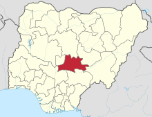
Nasarawa State
State of NigeriaNasarawa is a state in the North Central region of Nigeria, bordered to the east by the states of Taraba and Plateau, to the north by Kaduna State, to the south by the states of Benue and Kogi, and to the west by the Federal Capital Territory. Named for the historic Nassarawa Emirate, the state was formed from the west of Plateau State on 1 October 1996. The state has thirteen local government areas namely, Nasarawa, Toto, Keffi, Karu, Kokona, Akwanga, Wamba, Nasarawa Eggon, Lafia, Obi, Awe, Doma and Keana with its capital in Lafia, located in the east of the state, while a key economic centre of the state is the Karu Urban Area—suburbs of Abuja—along the western border with the FCT.
Read article
Top Questions
AI generatedMore questions
Nearby Places
New Nyanya


