Map Graph
No coordinates found

U.S. Route 1

North-south U.S. route from Florida to Maine

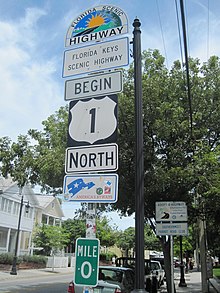
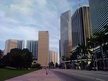
U.S. Route 1 or U.S. Highway 1 (US 1) is a major north–south United States Numbered Highway that serves the East Coast of the United States. It runs 2,370 miles (3,810 km) from Key West, Florida, north to Fort Kent, Maine, at the Canadian border, making it the longest north–south road in the United States. US 1 is generally paralleled by Interstate 95 (I-95), though US 1 is significantly farther west and inland between Jacksonville, Florida, and Petersburg, Virginia, while I-95 is closer to the coastline. In contrast, US 1 in Maine is much closer to the coast than I-95, which runs farther inland than US 1. The route connects most of the major cities of the East Coast from the Southeastern United States to New England, including Miami, Jacksonville, Augusta, Columbia, Raleigh, Richmond, Washington, D.C., Baltimore, Philadelphia, Newark, New York City, New Haven, Providence, Boston, and Portland.

Read article
File:US_1.svgFile:US_1_(FL).svgFile:Southernmost_point_of_U.S._Highway_1.jpgFile:Moser_Channel_top.jpgFile:Southern_Biscayne_Boulevard.jpgFile:Augsky2.JPGFile:Beltline1.JPGFile:14thStreetbridgeWashingtonDC.jpgFile:2016-06-11_10_03_44_View_south_along_U.S._Route_1_(Conowingo_Road)_in_Conowingo,_Cecil_County,_Maryland,_approaching_the_Conowingo_Dam_on_the_Susquehanna_River.jpgFile:US_1_NB_past_PA_532.jpegFile:Pulaski_Skyway_full_view.jpgFile:Boston_skyline_from_Malone_Park,_Chelsea,_February_2014.jpgFile:Memorial_Bridge_(Portsmouth,_New_Hampshire)_April_2016.JPGFile:Start_US_Highway_1.jpgFile:Photograph_of_a_road_sign_along_the_highway_in_Key_West,_Florida,_announcing_the_beginning_of_U.S._Route_1_to_Fort..._-_NARA_-_200542.jpg
Top Questions
AI generated

List the top facts about U.S. Route 1

Summarize this article

What is the single most intriguing fact about U.S. Route 1?

Are there any controversies surrounding U.S. Route 1?

More questions